
Service Assessment
The Central Texas Tornadoes of
May 27, 1997
U.S. DEPARTMENT OF COMMERCE
National Oceanic and Atmospheric Administration
National Weather Service
Silver Spring, Maryland
Cover:
Left: Ground view of the Jarrell tornado on May 27, 1997, between 3:40-3:45 p.m. Central
Daylight Time (CDT), just before it entered the Double Creek Estates subdivision. Photograph
courtesy of Scott Beckwith, Jarrell, Texas.
Right: Aerial view taken May 31, 1997, of a portion of the Double Creek Estates subdivision in
Jarrell, Texas. Note that only the home foundations remain. Photograph by L. Phan, National
Institute of Standards and Technology (NIST).

Service Assessment
The Central Texas Tornadoes of
May 27, 1997
April 1998
U.S. DEPARTMENT OF COMMERCE
William M. Daley, Secretary
National Oceanic and Atmospheric Administration
D. James Baker, Administrator
National Weather Service
ii
John J. Kelly, Jr., Assistant Administrator
Preface
Participation on a Service Assessment survey team is both a rewarding and potentially trying
experience. Witnessing the personal tragedy caused by a disaster and assessing services provided
by the National Weather Service (NWS) are responsibilities not taken lightly. Reports on natural
disasters are very important. The recommendations, which represent the team’s views, are given
careful consideration by the Agency in its attempts to continuously improve warning services.
The magnitude of this event made it emotionally troubling for every team member. I wish to
express sincere appreciation to the Service Assessment Team members for their thorough,
professional, and unbiased review of the disaster and for their recommendations toward service
improvements.
Robert S. Winokur
Acting Assistant Administrator for
Weather Services
April 1998
iii
Foreword
This report on the series of tornadoes which struck central Texas on May 27, 1997, was prepared
by a National Oceanic and Atmospheric Administration (NOAA) Service Assessment Team
following a 4-day visit to the storm sites. The meteorological analyses presented in the report
were developed by the Team during a 4-month period following the on-site assessment. The team
has drawn upon a number of external resources, including the Storm Prediction Center (SPC),
National Environmental Satellite, Data, and Information Service (NESDIS), Operational Support
Facility (OSF), and university resources to make the interpretations of the severe weather setting.
It should be noted that the meteorological analyses and interpretations, since they were done after
the fact, make use of all available information. Some of the charts and photographs shown in this
report were not available to the staffs of the Next Generation Weather Radar (NEXRAD)
Weather Service Forecast Offices (NWSFOs) Dallas/Fort Worth and Austin/San Antonio, Texas,
prior to the occurrence of the tornadic thunderstorms.
The report is based upon information gathered by the team through a visit to the Austin/San
Antonio NWSFO in New Braunfels, Texas; aerial and ground surveys of three of the tornado
track sites; and interviews with members of other agencies and organizations and state, county
and municipal governments. The team expresses its appreciation to the county and municipal
officials who took time from urgent disaster response duties to share their impressions of the
event and interpretations of the effectiveness of NWS products and services. Similarly, the team
would like to extend its appreciation to the staffs of the Dallas/Fort Worth and Austin/San
Antonio NWSFOs for making themselves readily available and for outlining their actions before
and during the event.
This report assesses the effectiveness of NWS products and services before and during the period
of the severe thunderstorms as they moved through central Texas. Furthermore, the report
presents the team’s facts, findings and recommendations as defined by their survey.
The Service Assessment Team

iv
Table of Contents
Page
Preface ................................................................ ii
Foreword .............................................................. iii
Service Assessment Team .................................................. v
Acronyms .............................................................. vi
Event Summary.......................................................... 1
Facts, Findings and Recommendations......................................... 15
Appendix A Chronology of Releases Related to the Central Texas Tornadoes ...... A-1
Chronology of Events at the Storm Prediction Center ............ A-1
Chronology of Events at NWSFO Fort Worth, TX .............. A-5
Chronology of Events at NWSFO Austin/San Antonio, TX........ A-9
Appendix B The Jarrell, Texas, Tornado Outbreak: A Meteorological Satellite
Perspective............................................... B-1
Appendix C Aerial Damage Survey of the Central Texas Tornadoes of
May 27, 1997 ............................................. C-1
Appendix D Persons Interviewed and/or Contacted by the Service Assessment
Team ................................................... D-1
Appendix E CDC Field Epidemiological-Health Report ....................... E-1
Appendix F Fujita Tornado Intensity Scale................................. F-1
Status of Actions......................................................... S-1

v
Service Assessment Team
Following a major severe weather event in which there has been extensive damage or loss of life,
a Service Assessment Team may be assigned by NOAA to evaluate the role played by the NWS,
to provide an objective appraisal of products and services, and to make findings and
recommendations for improving the service. Such a team was assembled to survey tornadic
thunderstorms which struck parts of central Texas on May 27, 1997. This document is the final
report from this team.
Team Members
Leader, James H. Henderson, Deputy Director, Aviation Weather Center, National Centers for
Environmental Prediction (NCEP), NWS, Kansas City, Missouri
Team Coordinator/Editor, Ida M. Hakkarinen, NWS Liaison and Meteorologist, NOAA Program
Coordination Office, Washington, D.C.
Assessment Facilitator, William H. Lerner, Meteorologist, Office Of Meteorology, NWS Headquarters,
Silver Spring, Maryland
Melvin R. McLaughlin, Chief, Meteorological Services Division, NWS Southern Region Headquarters,
Fort Worth, Texas
James M. Looney, Chief, Meteorological Services Division, NWS Central Region Headquarters, Kansas
City, Missouri
E. L. (Buddy) McIntyre, Chief, Transition Management Unit, NWS Southern Region Headquarters,
Fort Worth, Texas
Brian E. Peters, Warning Coordination Meteorologist (WCM), NWS NWSFO Birmingham, Alabama
Marilu Trainor, NOAA Public Affairs Specialist, NWS Western Region Headquarters,
Salt Lake City, Utah
Dr. Enrique Paz, U.S. Centers for Disease Control and Prevention (CDC), Atlanta, Georgia
Dr. Shellie Ann Kolavic, Epidemic Intelligence Service, CDC, Texas Department of Health (TDH),
Austin, Texas
David Zane, Director, Injury Prevention and Control Program, TDH, Austin, Texas
Adjunct Member
Dr. Long T. Phan, Professional Engineer, Structures Division, NIST, Gaithersburg, Maryland
(accompanied Brian Peters on the aerial surveys)
vi
Acronyms
ARC American Red Cross
AVHRR Advanced Very High Resolution Radiometer
AWIPS Advanced Weather Interactive Processing System
CCelsius
CAPE Convective Available Potential Energy
CDC U.S. Centers for Disease Control and Prevention
CDT Central Daylight Time
CIMSS Cooperative Institute for Meteorological Satellite Studies
CIRA Cooperative Institute for Research in the Atmosphere
CR County Road
CST Central Standard Time
CSTAR Collaborative Science, Technology, and Applied Research Program
CWA County Warning Area
DLF Del Rio, Texas (DOD radar site at Laughlin Air Force Base)
DMIC Deputy Meteorologist in Charge
DOD Department of Defense
EAS Emergency Alert System
EWX Austin/San Antonio NWSFO, New Braunfels, Texas
FCC Federal Communications Commission
FWD Dallas/Fort Worth NWSFO, Fort Worth, Texas
FEMA Federal Emergency Management Agency
FFA Flash Flood Advisory
FFW Flash Flood Warning
FLW Flood Warning
ft feet
GOES Geostationary Operational Environmental Satellite
GPS Global Positioning System
GRK Granger, Texas, WSR-88D (DOD radar site at Fort Hood)
J/kg Joules per kilogram
km kilometer
LI Lifted Index
LSR Local Storm Report
m /s meters squared per second squared
22
mb millibar
MCS Mesoscale Convective System
MESO Mesocyclone Algorithm-Signature
MIC Meteorologist in Charge
NAWAS National Warning System
NCEP National Centers for Environmental Prediction
NESDIS National Environmental Satellite, Data, and Information Service
NEXRAD Next Generation Weather Radar

vii
NIST National Institute of Standards and Technology
nm nautical miles
NOAA National Oceanic and Atmospheric Administration
NOW Short Term Forecast (nowcast)
NWR NOAA Weather Radio
NWS National Weather Service
NWSFO NEXRAD Weather Service Forecast Office
OSF Operational Support Facility
RAMM Regional Atmospheric Modeling System
RAMSDIS RAMM Advanced Meteorological Satellite Demonstration and Interpretation
System
RVS River Statement
SEL Tornado Watch
SPC Storm Prediction Center
SPS Special Weather Statement (e.g., Hazardous Weather Outlook)
SR State Road
SVR Severe Thunderstorm Warning
SVS Severe Weather Statement
TDH Texas Department of Health
TLETS Texas Law Enforcement Telecommunication System
TOR Tornado Warning
TVS Tornado Vortex Signature
m micrometer
USWRP U.S. Weather Research Program
UTC Coordinated Universal Time
VAD Velocity Azimuth Display
WCM Warning Coordination Meteorologist
WFO Weather Forecast Office
WSR-88D Weather Surveillance Radar-1988 Doppler
ZFP Zone Forecast Product
1
Event Summary
Overview
During the mid-afternoon and early evening of May 27, 1997, a severe weather outbreak
produced numerous severe thunderstorms and multiple tornadoes across central Texas. The
synoptic weather situation that occurred was an atypical pattern for springtime central Texas
tornadoes. Outbreaks of Texas tornadoes are usually associated with a “classic” meteorological
pattern that has a strong mid-level (500 millibar [mb]) trough of low pressure combined with
favorable jet stream winds and integral strong low-level boundaries to form and enhance the
thunderstorms.
On this day, the 500 mb low center was located well to the north over Nebraska, and the upper-
level jet stream axis was over northern Oklahoma. There was not a well defined low-level jet. A
weak cold front extended from northeastern Texas southwestward to near Del Rio. The
numerous severe thunderstorms that occurred throughout central Texas developed in a situation
of weak wind shear and high thermodynamic instability, along the surface boundary, where the
greatest threat is typically strong winds and large hail. On this day in central Texas, there were 34
reports of severe weather—12 for large hail and 22 for tornadoes.
The F5 tornado (see Appendix F, Fujita Tornado Intensity Scale) that occurred near the
unincorporated community of Jarrell in Williamson County caused 27 of the 30 fatalities. Another
tornado death occurred in Cedar Park, which is also in Williamson County. In Travis County,
The Pedernales Valley tornado killed one person. One additional death from drowning occurred
at Shoal Creek in Austin.
Since 1950, there have been 40 tornadoes in Williamson County. On April 7, 1980, an F3
tornado killed one and injured two. A May 17, 1989, tornado (also rated an F3) killed one and
injured 28. Since 1950, 46 tornadoes have occurred in Travis County. On July 4, 1970, an F2
tornado killed one and injured four. Until May 27, 1997, there had never been an F5 or F4
tornado reported in either Williamson or Travis County.
Meteorological Situation
(Italicized sections contain detailed information which may be of more interest to technically
oriented individuals.)
In the early morning hours of May 27, a large Mesoscale Convective System (MCS) developed
over Arkansas and eastern Oklahoma. The MCS moved slowly eastward and produced gravity
waves that radiated away from the system. An analysis of the satellite data, using sophisticated
tools not available to the Austin/San Antonio NWSFO (EWX) forecasters, showed that one of
2
these gravity waves appears to have played a role in the initiation of the thunderstorm complex
that eventually produced the tornado activity when it intersected the cold front in the vicinity of
Waco. However, this gravity wave moved south of the storm complex before the beginning of the
tornado activity.
Meteorological conditions were conducive to widespread severe convection during the afternoon
of May 27. Area upper air soundings indicated extreme instability. Modified Convective
Available Potential Energy (CAPE) exceeded 7500 Joules per kilogram (J/kg) in central Texas.
(CAPE is a measure of the amount of energy available for convection and is directly related to
the maximum potential vertical speed within a thunderstorm updraft. Higher values for CAPE
indicate a greater potential for severe weather. Observed values in thunderstorm environments
often exceed 1000 J/kg; in extreme cases, values may exceed 5000 J/kg.)
Although the atmospheric instability was extreme, the environmental wind fields were not
indicative of those typically expected for supercell thunderstorm development. Vertical wind
shear in the atmosphere is an important ingredient for tornadic development. Storm-relative
helicity is used by NWS meteorologists to quantify this vertical wind shear. In particular, the
measure of helicity in the lowest 3 kilometers (km) of the atmosphere (3 km helicity) is used
extensively. In general, 3 km helicity values below 300 meters squared per second squared
(m /s ) correlate to weak tornadoes.
22
On May 27, winds were relatively light through much of the lower atmosphere, and storm-
relative helicity values from the 7 a.m. CDT NEXRAD Weather Service Office Corpus Christi
sounding were 70 m /s . (Note: All times listed are in Central Daylight Time.) A forecast
22
sounding from the Rapid Update Cycle numerical model, valid for 7 a.m. near the Austin, Texas,
area, had values of 117 m /s . Consequently, the convection was strongly influenced by storm-
22
scale processes and confined to the vicinity of the existing surface boundaries.
The thunderstorm complex that would eventually become tornadic and produce the Jarrell
tornado developed in McLennan County over the southern sections of Waco around 12:40 p.m.
in the Dallas/Fort Worth NWSFO (FWD) county warning area. The storm developed rapidly and
produced its first tornado at 1:20 p.m. near Lorena, approximately 15 miles south of Waco in
southern McLennan County. This tornado, classified as very briefly reaching category F1,
damaged several mobile homes and severely damaged one frame house 2 miles west of Lorena.
The storm continued to intensify and propagate southward and produced a second, much stronger
tornado near Moody in extreme southern McLennan County, about 22 miles south of Waco, at
1:45 p.m. The Moody tornado, classified as an F3, had a path length of 3.7 miles and a width of
150 yards. It did extensive damage to trees, destroyed a house and a barn, damaged another small
house, and tossed a car and a pickup truck several hundred feet.
A third tornado was produced by this same storm complex in Bell County near Belton at
2:35 p.m. This F3 tornado began near Morgan’s Point on the north side of Lake Belton, crossed
the lake, and came ashore near the community of Woodland, creating a path 1.4 miles long and
275 yards wide. The Belton tornado reached its maximum intensity after crossing the lake,
causing total destruction to trees and substantial damage to structures.
3
Early radar data of these storms from the EWX Weather Surveillance Radar-1988 Doppler
(WSR-88D) were significantly range-folded due to second trip ground clutter. An analysis of the
radar data showed that when the storm emerged from the range-folded area at 2:56 p.m., about
20 minutes prior to the development of the Jarrell tornado, there was a deep mesocyclone of
minimal strength in southern Bell County. Mesocyclonic rotation strengthened to moderate to
strong values (>40 knots at 70 nautical mile [nm] range) and a strong and deep gate-to-gate
signature was detected in southern Bell County at 3:19 p.m. Gate-to-gate velocity differences
continued to be strong until after the 3:43 p.m. radar volume scan.
The aerial survey (see Appendix C) showed that the final and most devastating tornado produced
by this particular storm complex developed near the community of Prairie Dell in the extreme
southern part of Bell County, approximately 3 miles north of the Williamson County line.
An analysis of the radar data from the Department of Defense (DOD) WSR-88D radar at
Granger, Texas (GRK), showed a detailed view of the developing circulation at 1,500 feet (ft)
elevation and above. Prior to the development of the tornadic circulation, two fine lines were
detected in the reflectivity field. The gust front on the western side of the Jarrell storm
intersected the larger scale wind shift boundary where the tornadic signature developed in an
area of strong and deep convergence. The tornadic circulation in the lowest 5,000 ft appeared
to link up with the mesocyclone rotation in the middle and upper levels. This radar ceased
operation at 3:38 p.m. and was no longer available to the EWX forecasters.
Actual time of the Jarrell tornado’s development was hard to pinpoint but is believed to be
between 3:15 p.m. and 3:20 p.m. Initially, the tornado was quite weak and small, probably being
no more than F0 or F1. The tornado moved slowly south-southwest, crossing into Williamson
County at approximately 3:25 p.m. Shortly thereafter, the tornado explosively strengthened,
becoming a multi-vortex F5 tornado before moving into the Double Creek Estates subdivision on
the west side of Jarrell at 3:40 p.m. Here, devastation was complete. The entire subdivision,
consisting of approximately 38 single-family structures and several mobile homes, was destroyed.
Three businesses, located adjacent to the subdivision, were also destroyed.
Even though the Jarrell storm produced a mesocyclone and a violent tornado, the radar
reflectivity field did not show a distinct hook echo directly preceding the tornado. A small hook
was apparent on the Granger radar data after the tornadic circulation developed. Although most
supercells contain mesocyclones on the right rear flank with respect to storm motion, the
mesocyclones on this day were located on the front flank (southwest quadrant) as they moved
slowly south-southwestward. The difference in mesocyclone location was probably due to
enhanced southwestward propagation along the boundary. Despite the fact that the reflectivity
features were not typical and could have somewhat confused a radar interpreter, the rotational
signals were clear and easy to follow.
Twenty-seven people perished in Jarrell. There were relatively few injuries reported—one serious
and less than ten minor, an inference to the small probability of survival. The Jarrell tornado had a
total path length of 7.6 miles and a maximum width of 3/4 mile. Shortly after exiting the Double
Creek Estates subdivision, the tornado dissipated and the parent tornadic storm itself weakened.
4
While the Jarrell tornado was evolving, a separate storm developed on the larger scale wind shift
boundary to the southwest.
On the flank of this new storm, the EWX radar detected an area of deep convergence with weak
shear around 3:25 p.m. that eventually evolved into the Cedar Park mesocyclone. The Cedar
Park circulation developed similarly to the Jarrell circulation in that it formed in an area of
strong convergence along the wind shift boundary in a large weak echo region (6 nm in
horizontal extent) well displaced from the low-level reflectivity field. The weak shear rapidly
intensified during the 3:48 p.m. radar volume scan, when a mesocyclone of moderate strength
was detected with maximum rotational velocities of 36 knots and a maximum radial velocity
difference of 70 knots at 50 nm from the radar. The moderate to strong mesocyclone rotational
velocities and strong gate-to-gate shear continued until about 4:12 p.m. and weakened
thereafter. The Cedar Park mesocyclone and gate-to-gate shears were different from their
Jarrell counterparts in that the strong signatures for Cedar Park remained aloft for much of the
time while the strong signatures for Jarrell were seen at all vertical levels.
The Cedar Park mesocyclone produced its first tornado at approximately 3:45 p.m. The tornado
began about 3.5 miles north of Cedar Park, which is also in Williamson County. This tornado
initially caused mainly F0 and F1 damage until it moved into the business district of Cedar Park at
4 p.m., where F3 damage was evident in a small area. An Albertsons Food and Drug Store was
severely damaged, and one person in the store was seriously injured as the tornado moved
through the shopping center. There were a number of other customers in the Albertsons store,
but the store manager had directed them into one of the store’s walk-in refrigeration units which
provided them safe refuge during the storm.
The Cedar Park tornado continued moving south-southwest, then gradually turned more
southwest as it moved through the Buttercup Creek subdivision on the southwest side of Cedar
Park. In the subdivision made up of well-constructed, upscale homes, damage ranged from F1 to
F3, with some homes suffering only minor roof damage while others suffered major damage. As
the tornado moved through the subdivision, 136 homes sustained damage. One person, a
69-year-old male, died from a cardiac arrest apparently as he was waiting out the storm inside his
truck in the garage.
The tornado then exited Cedar Park and dissipated about 1.1 miles from the northern shore of
Lake Travis in Travis County. As were all of the tornadoes on this day, the Cedar Park tornado
was slow-moving. In fact, some residents videotaped the approaching funnel for 10 to 15 minutes
and still had ample time to seek shelter in interior rooms of their homes before the wind began to
increase with the approach of the vortex itself. The Cedar Park tornado path dimensions were 9.2
miles in length and 250 yards in maximum width.
A second tornado developed from this storm complex near the south shore of Lake Travis around
4:30 p.m. As it rapidly achieved at least F3 intensity, it caused extensive damage to a marina on
the lake shore. Then increasing to F4 intensity, it severely damaged a reinforced building
containing a telephone switching center and completely destroying a stone house nearby, leaving
the foundation slab swept clean.

5
The tornado initially moved just south of west before turning southwest for a short distance, then
back to the west-southwest before moving into the Hazy Hills subdivision of the Pedernales
Valley in western Travis County. The tornado was a strong F3, with some evidence of F4
intensity, as it moved through the subdivision destroying numerous houses and mobile homes. A
25-year-old male died when he was either blown from his mobile home or from his pickup truck
as he attempted to flee the storm. The Pedernales Valley tornado damaged or destroyed
45 homes and a Southwestern Bell telecommunications switching center. It had a path length of
5.6 miles with a maximum width of 440 yards.
One additional death from drowning occurred at Shoal Creek in Austin. This fatality, a 38-year-
old female, was likely a result of the localized flash flooding that accompanied the storm system.
NWS Products and Services
The possibility of severe thunderstorms on this day had been anticipated. The NWS’s SPC, part
of the NCEP and located in Norman, Oklahoma, had placed the area in a moderate risk of severe
thunderstorms in the Severe Weather Outlook that was issued at 1:03 a.m. on Tuesday morning,
May 27.
As the severe weather event progressed during the day, the SPC continued to monitor the
development and subsequently issued two tornado watches for the area as well as several status
updates. The SPC issued Tornado Watch #338 at 12:54 p.m. for portions of east Texas, valid
from 1:15 p.m. until 7 p.m. This included Bell, McLennan and Williamson Counties. At
3:31 p.m., the SPC issued Tornado Watch #340 for south Texas, including Williamson and Travis
Counties, valid from 3:45 p.m. until 10 p.m. (Refer to Appendix A for details of SPC actions.)
NWSFO Dallas/Fort Worth Products
The NWSFO Dallas/Fort Worth office issued a Severe Weather Outlook at 5:32 a.m. The
Outlook noted there was a moderate risk of severe thunderstorms during the afternoon and night
over much of north Texas, including Bell and McLennan Counties. Subsequent forecasts and
discussions issued in the late morning continued to mention the threat of severe weather. (Refer
to Appendix A for a chronology of NWSFO FWD actions.)
Forecasters were obviously concerned about the extreme atmospheric instability in evidence on
this day. In an updated Severe Weather Outlook for North Texas issued at 12:20 p.m., NWSFO
FWD stated:
High instabilities aloft mean that thunderstorms that do form in the slight risk
area should rapidly become severe.
Nevertheless, forecasters were still focusing on the threat of large hail and damaging straight-line
winds rather than tornadoes. This was because of a lack of strong vertical wind shear as
6
evidenced by early morning atmospheric soundings. In the same Severe Weather Outlook
mentioned above, the forecaster went on to state:
Strong vertical motions in these storms...due to strong CAPES [convective
available potential energy]...suggest a main threat of large hail or damaging
straight-line winds. Weak wind shear profiles suggests that the tornado potential
is low.
As convection began to develop in McLennan County shortly before 12:45 p.m., the NWSFO
FWD wasted no time in immediately issuing a severe thunderstorm warning for the county at
12:50 p.m., anticipating that the storm would quickly become severe in the extremely unstable
atmosphere. Shortly thereafter, at 12:54 p.m., the SPC issued Tornado Watch #338. This watch
was valid from 1:15 p.m. until 7 p.m. and included McLennan and Bell Counties, as well as
Williamson County further to the south.
As the NWS WSR-88D in Fort Worth began showing significant updraft rotation in the
McLennan County storm, the office quickly switched to tornado mode and issued a tornado
warning for McLennan County at 1:21 p.m., noting that the radar was detecting a tornado near
Hewitt, a suburb of Waco located approximately 14 miles north-northeast of Moody. A severe
weather statement at 1:26 p.m. noted the tornado was west of Lorena, approximately 10 miles
north-northeast of Moody. The tornado was now confirmed by spotters as well as being detected
by the WSR-88D. At 1:48 p.m., the NWSFO FWD issued a tornado warning for Bell County
stating:
National Weather Service Doppler radar detected a tornado between Eddy and
Moody. This tornado has been confirmed by storm spotters.
A follow-up severe weather statement at 2:16 p.m. noted:
Spotters and radar continue to track a tornado located in northern Bell County
near Highway 317 and Southerland Road at 2:15 p.m. If you live in Moffat or
Morgans Point Resort...take cover immediately.
Subsequent storm surveys indicated a weak tornado (probably F0 or F1) lasting about 3 minutes,
occurred at Lorena at 1:20 p.m. A brief but intense tornado (classified as F3) occurred at Moody
at 1:45 p.m., and another brief F3 tornado occurred at Lake Belton, Bell County (Morgans
Point), at 2:35 p.m.
The NWSFO FWD issued the first tornado warning at 1:21 p.m. for McLennan County, 24
minutes prior to the tornado at Moody but minus 1-minute lead time for the county (the Lorena
tornado). This was followed at 1:48 p.m. by a tornado warning for Bell County (that was
extended at 2:30 p.m.), providing a 47-minute lead time for the county (the Lake Belton tornado).
The NWSFO FWD issued a total of ten tornado warnings, five severe thunderstorm warnings,
nine severe weather statements, and eight short-term forecasts during the 4-hour period from

7
1 p.m. until 5 p.m. on the afternoon of May 27.
NWSFO Dallas/Fort Worth Staffing
During the period from 12 noon until 5 p.m. on May 27, the NWSFO FWD was operationally
staffed in the following manner. The Forecaster in Charge and a journeyman forecaster handled
the routine forecast operations. A meteorologist intern was in training with the Forecaster in
Charge on the synoptic (long-term) desk. As convective activity began to develop, the WCM
assumed operation and monitoring of the WSR-88D, initially the NWSFO FWD WSR-88D and
then the DOD GRK WSR-88D as the activity moved south. (The Fort Worth NWSFO is an
associated user of the DOD GRK radar.) The Meteorologist in Charge (MIC) also assumed
operational duties, assisting with the radars and issuing warnings. A second meteorologist intern
assisted with coordination activities and in warning issuance, dissemination, and confirmation of
receipt. Two hydrometeorological technicians provided public service and NOAA Weather Radio
(NWR) programming, and a summer aide assisted with the phone load and NWR programming.
A second journeyman forecaster was called in on overtime at 3 p.m. to assist with warning
operations. In addition to the “normal” operational staffing, the NWSFO FWD used seven
additional personnel to handle this severe weather event.
NWSFO Austin/San Antonio Products
Forecasters at the Austin/San Antonio office were also concerned about the very high CAPE
values present in the atmosphere on May 27. (Refer to Appendix A for a chronology of NWSFO
EWX actions.) The forecast discussion issued at 3:40 a.m. noted the unstable air mass present
over the area, and stated, “...will mention possibly severe (thunderstorms) for this afternoon.”
Subsequent public forecasts which included the counties of Williamson and Travis called for a 30
percent chance of showers and thunderstorms, some possibly severe. In addition, the NWSFO
EWX issued a Hazardous Weather Outlook at 6 a.m., calling for the possibility of severe
thunderstorms area wide during the afternoon and extending into the nighttime hours. Another
forecast discussion issued at 10:15 a.m. dropped mention of severe weather, but an updated
Hazardous Weather Outlook issued at 11:15 a.m. continued the call for possible severe
thunderstorms and isolated tornadoes and was headlined “...Severe Thunderstorm and Heavy
Rain Event Developing Across South Texas and the Hill Country this Afternoon and Tonight....”
The Outlook went on to state:
“The atmosphere is very moist and unstable across south Texas. Conditions are
becoming increasingly favorable for the development of scattered severe
thunderstorms with large hail...damaging winds and very heavy rainfall. The
most severe storms may produce isolated tornadoes.”
Following the SPC’s issuance of Tornado Watch #338 at 12:54 p.m., which included Williamson
County, the NWSFO issued updated zone forecasts at 1:09 p.m., headlining the watch in the
appropriate zones. A Short Term Forecast issued at 1:10 p.m. for Williamson and Travis
Counties was headlined with the watch information but noted no significant precipitation was
indicated on radar.
8
At 2:15 p.m., the staff contacted both the Georgetown Police Department and the Williamson
County Sheriff’s Department to alert them that severe thunderstorms were moving southward
through Bell County and that severe weather was very likely in the next 1 to 1 ½ hours.
At 2:48 p.m., another Short Term Forecast was issued for Williamson and Travis Counties and
mentioned “...radar indicated a severe thunderstorm centered just west of Temple moving slowly
southwestward. Through 5 PM...partly cloudy skies will prevail with scattered showers and
thunderstorms developing by late afternoon...some could possibly be severe....” This forecast
also headlined the existence of the tornado watch for Williamson County.
The forecast discussion issued at 2:50 p.m. emphasized a heavy rain threat. The discussion stated
in part:
“Complicated weather pattern setting up with weak cold front dropping through
hill country tonight then upper level disturbance near 300 mb moves across south
central Texas at or about 18Z Wednesday. Tricky to decide where and when
heaviest rain will fall because amounts will be high requiring FFA [Flash Flood
Advisory] if activity is anything more than scattered.
...Service hydro feels activity and boundary will remain mostly stationary and
drift slowly southward and get intercepted by upper level 300 mb disturbance
early Wednesday AM 12-18Z producing very heavy rain across escarpment
area....After discussion with staff...rather than issue blanket FFA will wait until
location of heavy rain becomes clearer....”
The next issuance from the NWSFO EWX was the tornado warning for Williamson County at
3:30 p.m. The text of the warning stated in part:
“At 3:25 p.m. a tornadic thunderstorm was located about 5 miles west of Jarral
[sic] moving southeast at 10 mph. This storm has had a history of producing
tornadoes and large hail. The City of Jarrel [sic] is in the path of this storm.”
This warning gave a lead time of 10 minutes for the town of Jarrell, but no lead time for the
extreme northern portion of Williamson County.
A few minutes later, at 3:35 p.m., the office issued a Short Term Forecast for Williamson and
Travis Counties (among others) stating:
“At 3:30 PM radar indicated a tornadic thunderstorm centered just north of
Jarrel [sic] with another developing rapidly north of Georgetown. Movement was
southwest at around 10 mph. Residents are warned these storms have a history of
producing baseball [size] hail and tornadoes across central Texas this afternoon.
Through 5 PM...severe thunderstorms are developing across northern portions of
south central Texas and should continue marching southwest.”

9
At 3:31 p.m., the SPC issued a subsequent tornado watch, #340, for south Texas which included
Williamson and Travis Counties. Tornado Watch #340 was posted at 3:45 p.m. and remained in
effect until 10 p.m.
At 4 p.m., the NWSFO EWX issued the routine afternoon package of zone forecasts for south
Texas. The forecast for Williamson and Travis Counties, in addition to the obligatory tornado
watch headline, called for “Mostly cloudy with a 50% chance of showers or thunderstorms...
some possibly severe with locally heavy rainfall.” This was followed at 4:09 p.m. with a tornado
warning for Travis County. The warning stated in part:
“At 4:05 PM a tornadic thunderstorm was located over Cedar Park. This storm
is moving south at 10 mph. This storm will move into northern portions of the
City of Austin by 4:30 PM. A tornado was spotted over Cedar Park in
Williamson county at 4 PM.”
This warning gave a lead time of 21 minutes for Travis County (the Pedernales Valley tornado).
As heavy rains accompanied the tornadic storms, a flash flood warning was issued at 4:34 p.m. for
both Williamson and Travis Counties, valid until 6:30 p.m.
The NWSFO EWX issued a total of eight tornado warnings, twenty-four severe thunderstorm
warnings, ten flash flood warnings, four severe weather statements and fourteen short-term
forecasts during the afternoon and evening of May 27. Approximately 80 percent of these
issuances took place after 5 p.m. It also should be noted that, in addition to tracking the tornadic
storm in Williamson and Travis Counties, the NWSFO EWX was working a second severe
thunderstorm complex which had developed to the west in Edwards County. After 6 p.m., more
widespread severe weather developed throughout much of the NWSFO EWX’s county warning
area (CWA).
NWSFO Austin/San Antonio Staffing
During the daytime hours on May 27 (8 a.m. to 4 p.m.), operational staffing at the NWSFO
EWX consisted of: (1) the Forecaster in Charge working the short-term forecast desk (Meso
desk) and responsible for monitoring the EWX radar; (2) a journeyman forecaster working the
synoptic (long-term) desk and responsible for monitoring the DOD WSR-88D radar at Del Rio,
Texas (DLF); (3) two hydrometeorological technicians—one operating and interpreting data from
the EWX WSR-88D and the other programming NWR; and (4) two meteorologist interns—one
handling public service duties and the other assisting the EWX and DOD DLF radar operations by
composing and issuing warnings. During this period of time, in addition to the “normal”
operational staffing, the NWSFO EWX used the MIC, the Deputy MIC (DMIC), and the WCM
to assist in working the early stages of the severe weather event.
During the late afternoon and evening hours (4 p.m. to midnight), staffing consisted of: (1)
Forecaster in Charge working the short-term forecast desk; (2) a journeyman forecaster working
the synoptic desk as well as operating and monitoring the EWX WSR-88D; (3) a second
journeyman forecaster monitoring the DOD DLF WSR-88D; (4) three meteorologist
10
interns—two handling public service and the phone load while the third intern assisted the DOD
DLF WSR-88D forecaster in issuing warnings. Also, two hydrometeorological technicians were
on duty—one assisting the EWX WSR-88D operator while the other handled programming the
NWR. The DMIC stayed on duty until 6:45 p.m. During the late afternoon and evening hours in
addition to the “normal” operational staffing, the NWSFO EWX used five additional personnel to
assist in working the latter stages of the event.
An analysis of the staffing and delivery of products issued by the meteorologists during the mid-
afternoon of May 27 indicated that the routine forecast packages were prepared and disseminated
on schedule. A hydrometeorological technician and a meteorologist intern operated and
interpreted the EWX WSR-88D for severe weather; neither of whom had completed formal
WSR-88D training at the OSF. Interviews also indicated the staff was somewhat perplexed with
the inconsistent behavior of the WSR-88D mesocyclone algorithm and a transitory weakening of
the storm. These facts, combined with the atypical meteorological situation, may have influenced
the warning decision process.
Dissemination
Communication of warning information, especially in Williamson and Travis Counties, was
somewhat problematic during this episode. The Emergency Alert System (EAS) was not
activated in a timely fashion in at least one case. The delay of 25-30 minutes was verified by a
representative of the Texas Broadcasters Association. According to local media representatives,
the delay in broadcasting warning information from NWFSO EWX to the general public via EAS
may have been caused by the media outlet choosing to manually activate EAS instead of allowing
automatic activation. This choice is prevalent throughout the central Texas area because
broadcasters maintain that, due to the number of warnings that can be issued, automatic activation
would cause too many interruptions of their programming. Such decisions are part of state and
local EAS plans.
The Texas Department of Public Safety Law Enforcement Telecommunication System (TLETS)
is used throughout the state to convey important information about criminal activity to agencies.
In addition to police-related messages, TLETS is used to distribute weather warning information
to law enforcement and emergency management agencies. TLETS functioned as designed
throughout the episode and was effective in communicating warning information to Williamson
and Travis Counties.
Public Response
The Service Assessment Team conducted interviews with residents of Jarrell, Cedar Park and the
Pedernales Valley to determine if the tornado warnings were received by the residents and if so,
their response to the warnings. Appendix D lists the persons contacted by the Service Assessment
Team. Concurrent with the NWS interviews, a team from the U.S. Centers for Disease Control
and Prevention and the Texas Department of Health conducted an assessment to describe
11
mortality and morbidity related to the tornadoes and to provide casual hypotheses for fatalities
and injuries. This report is provided in Appendix E.
Almost everyone interviewed said they were aware of the tornado warnings. Most said they first
learned of the warnings through commercial television. Others said they received telephone calls
from relatives or friends about the approaching storms. Although most were aware of the
availability of the NWR, no one mentioned NWR as a source of receiving the tornado warnings.
Due to the slow movement and high visibility of the tornadoes, most of the residents interviewed
said they watched the approach of the tornadoes prior to taking shelter. Most said they knew to
go to the center of their houses, to avoid staying in mobile homes, and to seek shelter rather than
trying to flee the tornadoes. These actions definitely saved lives. However, in the case of the F5
tornado at Jarrell, people were killed even though they took the appropriate safety measures.
Actions taken by the residents of Buttercup Creek (Cedar Park tornado) and Hazy Hills
(Pedernales Valley tornado) attest to the value of tornado preparedness efforts and adherence to
tornado safety rules. Although approximately 175 homes were damaged or destroyed in these
two subdivisions, there was only one fatality and no serious injuries. The single fatality, in the
Hazy Hills subdivision, occurred either when the occupant was blown from his mobile home or
from his pickup truck as he attempted to flee the storm.
Media stories written and aired during the aftermath highlighted people in the path of the Jarrell
tornado who fled the area and survived while many others who obviously followed prescribed
safety measures perished. Media reports such as this provide conflicting guidance to the public
about appropriate safety measures. This “mixed message” may lead to some people in the future
trying to flee the storm area rather than seeking appropriate shelter.
It appeared through interviews with store and restaurant managers that formal tornado or other
severe weather safety plans for protection of employees and customers did not exist. The
Albertsons grocery and Taco Bell managers in Cedar Park, however, instructed their employees
to move to reinforced areas of their buildings. In the case of the Albertsons store, which
sustained significant damage, these actions undoubtedly saved many from serious injury and
possibly death.
Two stories told to the Service Assessment Team illustrate how knowledge of tornado safety
rules can save lives. The manager of the Albertsons grocery store in Cedar Park went outside into
the parking lot to watch the approaching thunderstorm. While approximately 60 customers were
shopping inside, he watched for a few minutes as the tornado developed. Going back inside the
store, he instructed that an announcement be made asking everyone to gather in the center of the
store so he could lead them into the store’s cooler in the rear of the building. He also asked
customers trying to leave the store to stay inside. Although the store’s wide-span roof collapsed
into the center of the store, the customers survived in the cooler with only a few minor injuries.
One store employee who did not make it into the cooler suffered serious injury. The actions of
the store manager saved many from certain serious injury and possibly death. When asked how he
knew to keep customers from fleeing the store and to move customers and employees into the
12
store’s cooler, the manager replied that he “was raised in Wichita Falls and was there during the
1979 tornado.” The 1979 Wichita Falls tornado killed more than 40 people. Over half the
fatalities in Wichita Falls occurred in automobiles, many of whom were trying to flee the tornado.
In the Jarrell tornado, structures in its immediate path were totally destroyed. A few residences
on the fringe of the tornado path, while sustaining nearly total destruction, still had some walls left
standing. In one such residence, a grandmother, her daughter, daughter-in-law and two young
grandchildren survived in a centrally located bathroom. The walls of the bathroom were all that
were left standing of the home. The grandmother and daughter told the Assessment Team that
they did not know where in the house to seek shelter from the tornado, which they could see
approaching them. The daughter told the Assessment Team, “My sister-in-law saved our lives.”
The daughter-in-law, who lived just down the road, had run to the house with her child to seek
shelter from the storm. She instructed everyone to get into the central bathroom. Her relatives
commented that she had picked the correct bathroom of the two in the house. She stated “But
you always go to the center of the house.” The Assessment Team asked how she knew about
what to do and she replied that she had “learned the [tornado] safety rules as a child.” Without
this knowledge and quick action on her part, there most certainly would have been five additional
fatalities in the Jarrell tornado.
Events related to the Jarrell tornado were indescribably tragic. It is the consensus of the Service
Assessment Team that most residents in the Double Creek Estates subdivision were aware of the
impending danger and knew the proper precautionary measures to take. Nevertheless, due to the
force (F5), width, and slow rate of movement of the tornado, the protective measures taken were
to no avail for those directly in its path of destruction.

13
Remains of a home adjacent to the Double Creek Estates subdivision of Jarrell.
This home is located on the edge of the tornado path. Five people survived the
storm in a bathroom (center of picture). Photograph by E. L. McIntyre, NOAA/NWS.
Home destroyed in Buttercup Creek subdivision during Cedar Park tornado.
Several people took shelter in a utility closet, shown just to the left of the woman
in the picture. Photograph by NWSFO Austin/San Antonio.

14
Aerial view of Albertsons grocery store showing damage from the Cedar Park
tornado. Photograph by L. Phan, NIST.
Ground view of damage to Albertsons grocery store. Photograph by M. Trainor,
NOAA.
15
Facts, Findings and Recommendations
A. Observations
Finding 1:
The amateur radio base station at NWSFO EWX was not activated for Tornado
Watch #338. The NWSFO EWX did try to contact the amateur radio coordinator for
Tornado Watch #340 but could not raise him. They also could not contact a backup
coordinator. No one on duty at NWSFO EWX knew how to turn on the amateur
radio equipment for passive monitoring. Therefore, vital spotter information was not
received via this amateur radio link. A meteorologist intern at NWSFO EWX
indicated he did receive one report via a phone call from an amateur radio operator.
Recommendation 1:
Personnel at NWSFO EWX should be trained in how to turn on the amateur radio
equipment so that they can at least hear reports, even if the network is not activated.
NWSFO EWX should also work with the amateur radio coordinator on backup
procedures for contacting key people in impending emergencies.
Finding 2:
The Fort Hood WSR-88D (GRK) (Granger, Texas, WSR-88D) ceased to function
after the 3:38 p.m. volume scan and remained out of service for a number of hours.
This radar is operated and maintained by the U.S. Air Force. The radar was located
only 20 miles from the Jarrell tornado. An associated Principal User Processor display
system from this radar is installed in the NWSFO FWD. The radar was invaluable to
NWSFO FWD for warnings issued in McLennan and Bell Counties. If the radar had
ceased to function earlier in the afternoon, warning operations would have been
severely impacted.
It was subsequently learned that the radar had shut down because of a commercial
power failure and that its emergency power failed to come on-line because a control
switch had been left in the improper position during a previous maintenance visit.
Recommendation 2:
The NOAA and the NWS should increase efforts in working with the DOD to ensure
that DOD commanders and personnel understand that properly maintained and
operated DOD WSR-88Ds are vital to the severe weather warning programs for both
the bases and the civilian populations under the radars’ umbrellas.
16
Finding 3:
Satellite data provided a number of valuable pieces of information for use in severe
thunderstorm nowcasting over Texas on May 27, 1997. (Appendix B provides a
research analysis of the May 27 events using NOAA meteorological satellite data.)
The storm complex that produced the tornado activity between Moody and the
Pedernales Valley on this day had cloud top features that are often associated with
thunderstorms that have very intense updrafts. The precise location, orientation and
movement of the front along which the tornadic storm complex evolved was easily
monitored using Geostationary Operational Environmental Satellite (GOES) imagery.
Unfortunately, real-time data flow into a satellite analysis and display system that
would have allowed for a number of useful applications was not available to the
NWSFO EWX forecasters.
Recommendation 3:
The NOAA/NWS should move rapidly to ensure that all Weather Forecast Offices
(WFOs) in the NWS are equipped with the best possible satellite analysis capabilities
that are part of the Advanced Weather Interactive Processing System (AWIPS). The
NWS should also provide proper training to ensure that satellite data are used in the
warning and forecast program.
B. Forecast Guidance
Finding 4:
A coordination call was not made from the SPC to NWSFO EWX prior to Tornado
Watch #338 being issued even though the watch included a part of NWSFO EWX’s
CWA. Such a coordination call may have further heightened the severe weather
awareness of the staff at the NWSFO EWX.
Recommendation 4:
The SPC should make every effort to coordinate with any NWS office that has
warning responsibility before a watch is issued that covers a part of the CWA of that
NWS office.
Finding 5:
The tornado outbreak was a unique event in that significant tornadoes were produced
in a situation of weak shear and high instability. Although storms exhibited supercell
characteristics (mesocyclones with tornadoes, weak echo regions, deviate storm
motion), an unusual storm evolution occurred. High thermodynamic instability and
17
storm interactions with a pre-existing wind shift boundary resulted in highly deviate
storm motion and the rapid development of mesocyclones and tornadoes. The
mesocyclone and tornado development formed farther ahead (to the southwest) of the
low-level radar reflectivity field than is typically observed. The mesocyclones grew
from areas of deep convergence within large weak echo regions characteristic of very
strong updrafts. While the evolution may have been unexpected, easily detectable
mesocyclones developed prior to the tornadoes. However, the mesocyclone
algorithm-signature (MESO) on the EWX WSR-88D was inconsistent and missed
several significant circulations. The tornado vortex signature (TVS) algorithm did not
trigger. The team is concerned with these failures.
Recommendation 5:
The OSF should evaluate the Level-2 Archive data from the EWX radar and further
investigate these anomalies. The NEXRAD Program should continue its plans to
implement the National Severe Storm Laboratory’s experimental mesocyclone
algorithm because of its higher skill and informative outputs, including probabilistic
guidance values.
Finding 6:
This outbreak of tornadoes was perceived as an unusual event in that the tornadoes
tracked to the southwest with several tracks having a right loop at the end. The storm
environment was characterized by weak vertical wind shear and high thermodynamic
instability. Interpretation of GOES satellite loop imagery suggests the possibility of a
gravity wave moving southwest across northern Texas and the lower Mississippi
Valley into this area of extreme low-level instability. This feature may have initiated
the first supercell thunderstorm that formed.
Recommendation 6:
A thorough scientific study of these events should be undertaken by researchers and
academicians with the results made available to forecasters of the NWS. Any study
should include the U.S. Weather Research Program (USWRP), the NWS
Collaborative Science, Technology, and Applied Research Program (CSTAR) and
NOAA/NWS Cooperative Institutes.
C. Watches, Warnings and Statements
FACT C1:
The actual time of the Jarrell tornado development was hard to pinpoint, but it is
believed to be between 3:15 p.m. and 3:20 p.m. Initially, the tornado was weak and
18
small, probably no more than F0 or F1. It moved slowly south-southwestward crossing
into Williamson County around 3:25 p.m. Shortly thereafter, the tornado explosively
strengthened to F5 before moving into the Double Creek Estates subdivision on the west
side of Jarrell around 3:40 p.m.
FACT C2:
The SPC issued Tornado Watch #338 at 12:54 p.m. for portions of east Texas valid
from 1:15 p.m. until 7 p.m. At 3:31 p.m., the SPC issued Tornado Watch #340 for
south Texas, including Williamson County, valid from 3:45 p.m. until 10 p.m.
FACT C3:
At 2:15 p.m., the NWSFO EWX staff phoned the Georgetown Police Department and
the Williamson County Sheriff’s Department to alert them that severe thunderstorms
were moving southward through Bell County and that severe weather was likely in the
next 1 to 1 ½ hours.
FACT C4:
NWSFO EWX issued a tornado warning for Williamson County at 3:30 p.m. This gave a
lead time of at least 10 minutes for the town of Jarrell but no lead time for the northern
portion of Williamson County.
Finding 7.1:
Individuals at NWSFO EWX who were directly associated with WSR-88D
manipulation and interpretation of the data it was providing on May 27, 1997, had not
attended the intense 4-week OSF operational training course. The OSF course has
been canceled, and the NWS is planning a new method of training for those personnel
who will manipulate and interpret the WSR-88D radar.
Finding 7.2:
Prior to the development of the Jarrell tornado, a series of mesocyclones had a history
of producing tornadoes in McLennan and Bell Counties in the NWSFO FWD’s CWA.
Early data on the storms from the NWSFO EWX WSR-88D were significantly range-
folded due to second trip ground clutter. This range-folding could have been
mitigated if the NWSFO EWX radar operators had changed the pulse repetition
frequency.
19
Finding 7.3:
Although most supercell thunderstorms contain mesocyclones on the right rear flank
with respect to storm motion, the mesocyclones on this day were located on the front
flank (southwest quadrant) as they moved slowly south-southwestward. The
difference in mesocyclone location is probably due to enhanced southwestward
propagation along the boundary. The storms emerged from the range-folded area on
the NWSFO EWX WSR-88D about 20 minutes prior to the development of the Jarrell
tornado. Despite the fact that the reflectivity features were not typical and could have
perplexed a radar interpreter accustomed to viewing radar reflectivity signatures alone,
the rotational velocity signatures were clear and easy to follow and should not have
confused an operator trained in WSR-88D data interpretation.
Finding 7.4:
Meteorologists trained in mesoscale events recognize that fluctuations in storm
strength should not be surprising when storms form in an environment of weak shear
but high instability. At the same time, with an explosively unstable thermodynamic
environment, transient weakening in existing convection should be viewed with
extreme caution. Furthermore, this “atypical” (see Finding 5) meteorological situation
may have influenced the performance of the WSR-88D MESO.
Recommendation 7:
Use and interpretation of the WSR-88D data, especially in convective situations,
should be left to meteorologists trained in both mesoscale meteorology and the
interpretation of WSR-88D data. In addition, NWS WFOs should be appropriately
staffed with a sufficient number of such meteorologists to meet these requirements.
Further, the NWS needs to ensure that any future training programs being developed
to replace the OSF WSR-88D course should be of equal or better effectiveness than
was that course. Meteorologists must have the ability to quickly interpret reflectivity
and velocity signatures within the context of the overall mesoscale weather pattern,
and relate the radar information to the other analyses and observing tools such as a
detailed mesoscale surface analysis combined with satellite, surface observations,
profiler and radar Velocity Azimuth Display (VAD) vertical wind profiles, etc.
Accordingly, the NWS should ensure that the expertise, materials, and other
resources, including field staff time, are made available to meet such a training
requirement.
Finding 8.1:
At NWS NWSFOs, the Forecaster in Charge on duty is the “supervising operational
meteorologist” and is responsible for warning and forecast operations, including severe
weather staffing and products, if a storm event develops. This procedure was not
20
implemented effectively at NWSFO EWX on May 27, 1997. Responsibility for severe
weather operations was assumed by a meteorologist intern and a radar operator.
During the early stages of the severe weather episode, no single forecaster supervised,
monitored and coordinated closely the activities and decision-making processes.
Finding 8.2:
As the severe weather approached the northern part of NWSFO EWX’s CWA, short-
term forecasts were limited in number and not sufficient. This occurred as the office
transitioned from a stance of routine operations into immediate full-scale warning
operations as the severe weather moved into the area. The office issued many more
short-term forecasts, as well as a number of severe weather statements, later in the
evening to supplement warnings on a number of tornadic events that occurred further
south in the southern portions of the NWSFO EWX’s CWA.
Finding 8.3:
The product mix flowing from the office early in the severe weather event did not
seem to be coherent in terms of the warnings, short-term forecasts and severe weather
statements.
Finding 8.4:
A review of the state forecast discussion and other products issued by NWSFO EWX
indicated that the office was focusing upon the potential for a heavy rain episode,
which did occur later in the evening, instead of tornadic activity. In addition,
interviews with the staff mentioned that, early in the severe weather episode, they were
concerned with getting the routine afternoon forecast package “out on time” and
devoted considerable resources to that effort.
Recommendation 8:
Management at NWSFO EWX should establish and enforce clear lines of authority
and responsibility to be followed during severe weather operations. Further, emphasis
should be given to keeping all staff current regarding such operational procedures.
Protection of life and property is the fundamental mission of the NWS. NWS offices
need to develop a strategy for a coherent product suite encompassing warnings,
statements and short-term forecasts throughout severe weather episodes. They need
to work with customers to apprise them of priority which will be placed upon products
during such events. All NWS WFOs should have a standing policy that routine
products have a much lower priority during periods of ongoing severe weather. They
should ensure that all staffing resources be brought into a cohesive severe weather
mind set and that the focus of the office is always on the fundamental mission.
21
D. Internal and External Service Coordination
Finding 9:
After the issuance of warnings, considerable staff resources were invested by NWSFO
EWX to confirm receipt of warning information by emergency management officials.
In some cases, multiple phone calls were made into the same county.
Recommendation 9:
The staff at NWSFO EWX is commended for their dedication and extra effort to seek
confirmation that warning information was being received by officials who had a
critical need for it. Nevertheless, it is recommended that NWSFO EWX work with
emergency management officials to seek alternative and more efficient methods to
confirm receipt of warnings.
Finding 10:
During the severe weather events of May 27, 1997, there were occasional delays in
coordination between the NWSFO FWD and the NWSFO EWX as the tornadic
situation shifted from NWSFO FWD’s CWA to NWSFO EWX’s CWA. The
coordination mechanism of choice, commercial telephone, was hampered by busy
signals. The Texas State National Warning System (NAWAS) circuit was available to
both FWD and EWX, but NWS offices in Texas use commercial telephones for
coordination because of various logistical problems associated with NAWAS.
The Texas NAWAS links intra-state warning points and NWS offices throughout
Texas. The circuit is divided into two sub-circuits, but Texas has made the decision to
operate the circuit as a single state-level circuit. Considering the size of the state, the
circuit can be busy with law enforcement traffic, and the state discourages its use for
routine business. It was noted that NAWAS traffic was heavy on May 27, and if NWS
personnel had chosen to use the circuit for coordination purposes, they may have had
to ask others to get off the circuit (an unlikely scenario in non-emergency,
coordination-only situations).
Nationally, NAWAS was in the process of being upgraded to better accommodate the
internal/external communication and coordination requirements of the NWS and the
emergency management community. Because of Federal budget constraints, the
upgrade has been halted, and Texas NAWAS terminals have not been fully upgraded.
Recommendation 10:
22
The NWS should reach consensus with the Federal Emergency Management Agency
(FEMA) and the state emergency management agencies on a single communication/
coordination system that is consistent nationally and meets the internal and external
communication/coordination requirements of both the NWS and the emergency
management community. All NWS offices should be provided with needed technology to
facilitate efficient internal and external coordination.
E. Dissemination
Finding 11.1:
There was a significant delay in the activation of the EAS. For example, the official
notification to EAS from the NWR was at 3:30 p.m. The EAS was not activated until
3:56 p.m. in at least one instance.
Finding 11.2:
Broadcasters maintain that the EAS “ticker” does not identify why EAS activation is
being requested. Consequently, they have to wait for hard copy which says “EAS
activation requested.” This introduces delays in the activation procedure.
Finding 11.3:
Media outlets apparently choose manual activation of EAS instead of automatic
activation. This choice is prevalent throughout the central Texas area because
broadcasters maintain that automatic activation would cause too many interruptions of
their programming.
FACT E1:
NWS policy only requires EAS activation requests on tornado warnings and flash
flood warnings.
Recommendation 11:
The NWS has sent to the Federal Communications Commission (FCC) proposed
revisions to the EAS rules. The NWS should continue to work with the FCC to clarify
situations that need automated activation. The NWS and the FCC, in cooperation
with the National Association of Broadcasters, should agree on a limited set of critical
weather warning products which would be programmed for automatic activation of
the EAS.
Finding 12:
23
The TLETS is designed to carry information primarily related to law enforcement
activities. It is not designed to be a weather warning dissemination system;
nevertheless, it is used by emergency managers and law enforcement agencies to
obtain weather information. In this particular event, TLETS was effective in
disseminating warning information in a timely manner. However, since TLETS is not
a totally automated system (i.e., it requires the manual routing of products), delays in
the dissemination of time-sensitive weather information can occur.
Recommendation 12:
The NWS should continue to work with the state of Texas Division of Emergency
Management to seek ways to improve the timely transmission of weather warnings via
TLETS and should intensify efforts on both a local and state level to explore
alternative methods of communicating critical weather products to emergency
management officials.
Finding 13:
The general public interviewed by the survey team did not use NWR as a first-choice
source of weather information. They relied on commercial radio and television. The
broadcast media, in general, used NWR as a backup source of severe weather
information, but not all radio stations have NWR receivers. Some emergency
managers used NWR as a primary source of severe weather information.
Recommendation 13:
The NWS should develop additional partnership initiatives with the public and private
sector to encourage the use of NWR for the receipt of critical weather information.
Finding 14:
The NWR transmitter serving Austin and surrounding communities lost power as the
storms moved through the general Austin area, and there is no backup power for the
site.
Recommendation 14:
All the NWR transmitters should be equipped with backup power.
24
F. Response
Finding 15.1
After the Jarrell tornado, which moved unusually slowly, there was a widespread belief
by the general population that persons who took appropriate safety actions were
killed, while persons who took inappropriate safety actions lived. This has prompted
questions from the public as well as the media regarding the viability of tornado safety
rules the NWS promotes.
Finding 15.2:
Through a limited number of interviews with people in the Cedar Park area, the
Pedernales Valley area, and even some people in the Jarrell area, the Service
Assessment Team found that lives were definitely saved because people took
appropriate safety actions in accordance with long-standing recommendations of the
NWS, FEMA, the American Red Cross (ARC) and the emergency management
community.
Recommendation 15:
The NWS, in concert with FEMA and the ARC, should continue to emphasize the
importance of not attempting to flee an approaching tornado and reemphasize the
importance of adhering to long established tornado safety rules. (In the vast majority
of situations, people who take shelter in sturdy, well-built structures will survive most
tornadoes whereas people who try to flee in automobiles will place themselves at much
greater risk.) The Service Assessment Team also recommends that there be significant
public and industry education on the meaning of well-built tornado shelters.
G. Preparedness
Finding 16:
The majority of managers of supermarkets, restaurants and other stores that the
Service Assessment Team interviewed did not have predetermined tornado or other
severe weather safety plans to activate for protection of their employees and
customers during severe weather threats. Worthy of note, however, is that the
Albertsons and Taco Bell managers in Cedar Park instructed their employees and
customers to move to a reinforced area of their buildings as the tornado approached.
The action of the Albertsons manager undoubtedly saved many lives.
25
Recommendation 16:
The NWS should partner with other public agencies and the private sector to develop
plans for protection of employees and the public located in large buildings during
severe weather threats.
H. System/Infrastructure
FACT H1:
NWS offices are typically staffed for fair weather situations. During difficult
mesoscale weather events, offices frequently have to either recruit all personnel on
duty, hold people on overtime, or call in whomever they can reach from home to help
with the increased workload associated with programming the NWR, operating and
interpreting data from WSR-88Ds, performing analyses, and assisting in warning
operations.
As the NWS continues to move forward with its restructuring, the staffing at offices, such
as the NWSFOs at Fort Worth and Austin/San Antonio, although currently augmented with
transitional staffing, is projected to decrease. The NWS also plans, in a multi-phased
approach, to decentralize severe weather watches from the SPC to the field WFOs. To
mitigate the workload associated with these and other responsibilities, the NWS is
depending upon AWIPS, an automated Console Replacement System for NWR, and the
integration of other functions to allow forecasters to more easily handle duties covering the
continuum of information.
Finding 17:
The workload associated with the events of May 27, 1997, challenged the staffs of the
NWSFOs involved. At NWSFO FWD, seven additional personnel beyond the normal
shift complement were pressed into service, including the MIC and WCM who were
intimately involved in the warning process. NWSFO Austin/San Antonio augmented
their normal shift structure with five personnel, including the MIC and Deputy MIC
who were on the forecast floor and available as necessary.
Recommendation 17:
First, the NWS should ensure that all field offices develop strategies that make full use
of all office personnel qualified to assist in warning and forecast operations during
critical weather situations.
Second, the NWS should evaluate its plans regarding future staffing and service changes to
ensure that workload constraints do not compromise the agency’s safety of life and property
26
mission. Specifically, transitional staffing which has been placed at selected offices should
be retained until such time as new technology can demonstrate it is capable of mitigating the
workload associated with warning and forecast operations to an extent that a reduction in
staff is feasible.
Finding 18:
Over 10,000 tornadoes have occurred in the United States during the last 10 years.
During that period of time, only six of these tornadoes have been rated as an F5. Of
those six, only two tornadoes occurred under the synoptically evident southwesterly
flow. The other four occurred in atypical westerly or northwesterly flow. Such
situations are often accompanied by extreme instability. The extreme instability is not
sufficient to determine storm type and/or tornado development since these same
patterns often produce bow echoes and associated derechos instead of tornadoes.
Extreme instability could play a role in tornado intensity through stretching or some
other storm-scale effect.
Recommendation 18:
Studies should be undertaken by the research and academic community to help identify
these types of patterns which may aid in the development of these rare but catastrophic
tornadoes. Such studies should have the participation of the USWRP, CSTAR, and
NOAA/NWS Cooperative Institutes. The results of these studies should be made
available to NWS forecasters to aid in the warning and forecast process.
Finding 19:
Since NOAA and the NWS do not have a Quick Response Hazards Survey Team in
place, it usually takes 48-72 hours to assemble a team and put that team into the
centroid of the outbreak. This is especially true for the aerial part of the survey which
allows highly detailed documentation which is necessary to support findings that are
generated by the NWS modernized suite of equipment. In the case of the central
Texas tornadoes, there were not a lot of trees and local authorities were quick to
repair damage and remove debris. This hampered the exact location of the damage
paths and the times of occurrence. The uncertainty of the times or the paths of
tornadoes makes it very difficult to analyze the data for current performance or
develop strategies for better future performance.
Recommendation 19:
NOAA/NWS should compile a list of potential, quick-response team members, drawn
from appropriate expertise in the NOAA line and staff offices, other Department of
Commerce Bureaus such as NIST, and from the universities and private sector. The
team should be interdisciplinary in nature. Following a significant tornado outbreak, a
27
team of three to five scientists should be assembled and dispatched to the centroid of
the outbreak within 24 hours. Teams should include meteorologists, a wind engineer,
and a social scientist, an epidemiologist and a public affairs specialist. Funding to
carry out the travel costs of the team and an aerial damage-mapping survey should be
set aside yearly in a revolving budget.

28
Aerial view of damage from the Moody tornado. Photograph by L. Phan, NIST.
Aerial view of damage to boats at Belton Lake from the Belton tornado.
Photograph by L. Phan, NIST.

29
Close-up aerial view of the remains of a home in the Double Creek Estates
subdivision of Jarrell. Photograph by L. Phan, NIST.
Close-up view of a home foundation in the Double Creek Estates subdivision of
Jarrell. Note the plumbing pulled out of the concrete in the center of the picture.
Photograph by NWSFO Austin/San Antonio.

30
Asphalt stripped from the road by the Jarrell tornado in the Double Creek Estates
subdivision. Photograph by I. Hakkarinen, NOAA/NWS.
Remnants of a mobile home trailer in the Double Creek Estates subdivision of
Jarrell. Photograph by NWSFO Austin/San Antonio.

31
Damage to a telephone switching station caused by the Pedernales Valley
tornado. Photograph by M. Trainor, NOAA.
Truck in the Hazy Hills subdivision that was blown up a hill by the Pedernales
Valley tornado. Photograph by I. Hakkarinen, NOAA/NWS.
A-1
Appendix A
Chronology of Releases
Related to the Central Texas Tornadoes
Chronology of Events at the Storm Prediction Center
From 1:00 am CDT through 11:00 pm CDT - Tuesday, May 27, 1997
103 AM DY1 CONVECTIVE OUTLOOK...MODERATE RISK OF SEVERE THUNDERSTORMS
FOR HAIL AND DAMAGING WINDS INCLUDING TRAVIS AND WILLIAMSON
COUNTIES...
1016 AM DY1 CONVECTIVE OUTLOOK...MODERATE RISK OF SEVERE THUNDERSTORMS.
NCLUDING TRAVIS AND WILLIAMSON COUNTIES...CONDS WILL BE FVRBL
FOR THE DVLPMT OF SCTD INTENSE STMS WITH VRY LRG HAIL..LCLY DMGG
WINDS AND PSBLY ISOLD BRIEF TORNADOES.
1254 PM AWW QUICKIE NOTIFICATION OF TORNADO WATCH 338
1254 PM SEL8 TORNADO WATCH #338 ISSUED FOR EAST TEXAS INCLUDING BELL,
MCCLENNAN AND WILLIAMSON COUNTIES. DISCUSSION MENTIONED VERY
LARGE HAIL/LOCALLY DAMAGING WINDS AND ISOLATED TORNADOES
POSSIBLE THIS AFTERNOON IN VERY UNSTABLE AIR ASS/CAPE TO 5000 J/KG/
OVER REGION. ANY TORNADOES WILL LIKELY BE CONFINED TO BOUNDARY
INTERSECTIONS GIVEN COMPARATIVELY WEAK VERTICAL SHEAR.
306 PM MCD STATUS OF TORNADIC STORM NEAR TPL...VERTICAL WIND PROFILES ARE
QUITE WEAK...WITH LATEST KEWX DATA SHOWING VARIABLE WINDS AT 5-
10 KNOTS THROUGH 700 MB. DEGREE OF INSTABILITY CERTAINLY
SUPPORTS LARGE HAIL AND WIND DAMAGE...BUT IT IS UNCLEAR HOW
TORNADIC SUPERCELL NEAR TPL WILL EVOLVE AS IT ENCOUNTERS
APPARENTLY WEAKER MID LEVEL FLOW OVER THE NEXT FEW HOURS. DUE
TO PROPAGATION OF THIS STORM AND EXPECTED RAPID DEVELOPMENT
OF NEW CONVECTION TOWARD DRT...A NEW TORNADO WATCH WILL BE
REQUIRED SOUTH AND WEST OF #338 SHORTLY.
331 PM AWW QUICKIE NOTIFICATION OF TORNADO WATCH 340
331 PM SEL0 TORNADO WATCH 340 ISSUED FOR SOUTH TEXAS INCLUDING WILLIAMSON
AND TRAVIS COUNTIES. DISCUSSION MENTIONED INTENSE
THUNDERSTORMS WITH VERY LARGE HAIL...HIGH WINDS AND ISOLATED
TORNADOES POSSIBLE THIS EVENING WHERE MODERATE LOW LEVEL
INFLOW OF VERY MOIST AIR CONTINUES BENEATH AXIS OF STEEP LOW TO
MID LEVEL LAPSE RATES AHEAD OF SOUTHEAST MOVING COLD FRONT.
DEEP LAYER VERTICAL SHEAR LIMITED...BUT TORNADOES STILL POSSIBLE
IN VICINITY OF BOUNDARY INTERSECTIONS.
A-2
339 PM WWA STATUS OF WW#338...ISOLD SVR TSTMS ARE OCCURRING OVR PARTS OF ERN
TX ALG/AHD OF WEAK SFC CDFNT. SUPERCELL NOW OVR BELL CNTY TX NR
TPL CONTS TO DVLP SLOWLY SWD ALG FRONT. THIS STORM HAS ALREADY
PRODUCED SVRL TORNADOES WITH RPTS OF SGFNT DMG. ANOTHER
SUPERCELL APPRS TO HAVE DVLPD OVR NAVARRO CNTY. TORNADO
THREAT SHUD REMAIN FOCUSED ALG BNDRY OVR
NAVARRO/HILL/MCLENNAN/BELL/WILLIAMSON/TRAVIS CNTYS NEXT 1-2
HOURS WHERE STG CONVERGENCE IS OCCURRING. WW 340 HAS JUST BEEN
ISSUED S OF CURRENT WATCH.
457 PM WWA STATUS OF WW#338...AN EXTRMLY UNSTBL AMS RMNS IN PLACE OVR MUCH
OF ERN TX/WRN LA. SFC OBS SHOW TEMPS IN THE UPR 80S AND LWR 90S
AND DWPNTS IN THE LOW TO MID 70S...YIELDING SFC BASED CAPE VALUES
AOA 4500 J/KG. THE STGST CELLS WERE CURRENTLY LOCATED IN
PONOLA...LIMESTONE...AND WILLIAMSON CNTYS. A TORNADO WAS RPRTD
WITHIN THE PAST HR IN CEDAR PARK IN NRN WILLIAMSON CNTY. THIS
PARTICULAR CELL CONTS TO MOV/PROPAGATE TO THE S AND WILL LIKELY
MOVE INTO WW 340 WITHIN THE NEXT HR OR SO. ALTHOUGH WNDS ARE
WK ALF...THERE IS STG VEERING IN THE LOW TO MID LVLS. GIVEN THE
DEGREE OF INSTABILITY...THE WND FIELDS SUG THE PTNL FOR FURTHER
TORNADIC DVLPMNT WL CONT FOR THE NXT SVRL HRS.
A-3
SPC Tornado and Severe Thunderstorm Reports
Partial Preliminary List For Texas
For 0600 Central Standard Time Tue May 27 1997
Thru 0600 CST Wed May 28 1997
EVENT LOCATION REMARKS
DATE/TIME
LAT/LON
.....TORNADO REPORTS...................TORNADO REPORTS..............TORNADO REPORTS......
1 TORN 3 W LORENA TX (16 S ACT) 27/1224
FTW/LSR 3138 9727
2 TORN 2 W LORENA TX (16 S ACT) 27/1254
SEVERAL MOBILE HOMES DAMAGED AND ONE HOUSE
DESTROYED FTW/LSR 3138 9725
3 TORN 1 E MOODY TX (11 NNE TPL) 27/1259
BUILDINGS DAMAGED FTW/LSR 3131 9733
4 TORN BELTON TX (5 SSW TPL) 27/1331
FTW/LSR 3106 9746
5 TORN 3 N BELTON TX (3 SW TPL) 27/1340
FTW/LSR 3111 9746
6 TORN 3 W BELTON TX (8 SW TPL) 27/1354
TORNADO BETWEEN NOLANVILLE AND BELTON
FTW/LSR 3106 9752
7 TORN BLOOMING GROVE TX (44 NE ACT) 27/1405
FTW/LSR 3210 9671
8 TORN 2 W HUBBARD TX (27 ENE ACT) 27/1450
FTW/LSR 3184 9683
9 TORN 6 N GEORGETOWN TX 27/1455
ALONG I-35 SAT/LSR 3073 9766
10 TORN LEANDER TX (20 NNW AUS) 27/1500
SAT/LSR 3058 9784
11 TORN JARRELL TX (25 SSW TPL) 27/1515
*** 30 DEAD *** SAT/LSR 3081 9759
12 TORN AUSTIN TX (2 WSW AUS) 27/1515
AUSTIN PD REPORTED TORNADO ON GROUND
NEAR 2222 AND ANDERSON MILL
SAT/LSR 3028 9774
13 TORN CEDAR PARK TX (13 NNW AUS) 27/1515
*** 2 DEAD *** REPORT OF GROCERY STORE
COLLAPSE IN CEDAR PARK. REPORTS
SAT/LSR 3049 9781
14 TORN AUSTIN TX (2 WSW AUS) 27/1550
TORNADO ON GROUND NEAR LAKEWAY AND 620
SAT/LSR 3028 9774
15 TORN LEANDER TX (20 NNW AUS) 27/1600
SAT/LSR 3058 9784
A-4
16 TORN KENDALIA TX (28 N SAT) 27/1745
SHERIFF REPORTS TORNADO IN SW BLANCO
COUNTY MOVING TOWARDS KENDALI
SAT/LSR 2996 9851
17 TORN BLANCO COUNTY (40 W AUS) 27/1745
TX SAT/LSR 3026 9838
SHERIFF REPORTS TORNADO IN SW BLANCO COUNTY
MOVING TOWARDS KENDALI
18 TORN BLANCO TX (38 N SAT) 27/1808
TORNADO ON GROUND SW OF BLANCO
SAT/LSR 3009 9841
19 TORN UTOPIA TX (27 NW HDO) 27/1900
SHERIFF REPORTED TORNADO ON GROUND
SAT/LSR 2961 9953
20 TORN MOUNTAIN HOME TX
(34 SE JCT) 27/1903
TORNADO REPORTED ALONG I-10 IN KERR
COUNTY SAT/LSR 3016 9936
21 TORN SISTERDALE TX (33 NNW SAT) 27/1930
HAM REPORTED POSSIBLE TORNADO ON GROUND
SAT/LSR 2996 9873
.............LRG HAIL/STRONG WIND RPTS..................LRG HAIL/STRONG WIND RPTS......
22 A275 BRUCEVILLE TX (14 NE TPL) 27/1305
FTW/LSR 3131 9723
23 A275 EDDY TX (13 NE TPL) 27/1306
FTW/LSR 3130 9725
24 A175 TROY TX (6 ENE TPL) 27/1325
FTW/LSR 3120 9730
25 A125 TATUM TX (25 ESE GGG) 27/1330
NWS COOP OBSERVER ON RUSK-PANOLA
COUNTY LINE REPORTED HAIL ON BOTH
SHV/LSR 3219 9433
26 A125 TATUM TX (17 S GGG) 27/1330
NWS COOP OBSERVOR ON RUSK-PANOLA
COUNTY LINE REPORTED HAIL ON BOTH
SHV/LSR 3213 9476
27 G52 ROUND ROCK TX (12 N AUS) 27/1545
SAT/LSR 3049 9768
28 A175 MEXIA TX (42 E ACT) 27/1553
FTW/LSR 3168 9650
29 G62 AUSTIN MUELLER MUNI ARPT TX
(0 E AUS) 27/1620
KAUS METAR PK WIND 02062/2220
SPC/LSR 3030 9769
30 G52 ROUND ROCK TX (12 N AUS) 27/1645
SAT/LSR 3049 9768
31 A175 DRIFTWOOD TX (23 WSW AUS) 27/1650
REPORTED BY SHERIFFS DEPT SAT/LSR 3011 9803

A-5
Chronology of Events at NWSFO Fort Worth, TX
From 5:00 am CDT through 6:00 pm CDT - Tuesday, May 27, 1997
Time Product Description
532 AM SPS SEVERE OUTLOOK FOR NORTH TEXAS...MODERATE RISK OF
SEVERE THUNDERSTORMS THIS AFTERNOON AND TONIGHT
GENERALLY SOUTHEAST AND EAST OF A KILLEEN, TO MERIDIAN
TO TEXARKANA LINE.
1100 AM SFD NORTH TEXAS FORECAST DISCUSSION. MORNING SOUNDINGS
SHOWING A STRONG CAPPING INVERSION OVER NORTH
TEXAS..HOWEVER, ABOVE THE CAP..A STEEP LAPSE LEADS TO
VERY STRONG INSTABILITY IF THE CAP IS BROKEN.
1130 AM ZFP BELL AND MCLENNAN COUNTIES. PARTLY CLOUDY WITH A 30
PERCENT CHANCE OF THUNDERSTORMS..SOME SEVERE AND
WITH LOCALLY HEAVY RAIN.
1250 PM SVR SEVERE THUNDERSTORM WARNING FOR MCLENNAN COUNTY.
A RAPIDLY DEVELOPING THUNDERSTORM LOCATED NEAR
WOODWAY CURRENTLY PRODUCING PEA TO MARBLE (SIZE)
HAIL...CONDITIONS ARE FAVORABLE FOR MUCH LARGER HAIL
BY 1 PM.
0.75 INCH HAIL REPORTED NEAR WOODWAY AT 110 PM.
1255 PM NOW FOR BELL AND MCLENNAN COUNTIES..SCATTERED
THUNDERSTORMS NOW IN PROGRESS WILL CONTINUE TO
DEVELOP AND WILL BE CAPABLE OF PRODUCING DAMAGING
WINDS AND LARGE HAIL.
121 PM TOR FOR MCLENNAN COUNTY. NWS DOPPLER RADAR INDICATES
TORNADO NEAR HEWITT.
126 PM SVS NWS RADAR INDICATES A TORNADO 3 MILES WEST OF LORENA
(MCLENNAN COUNTY). STORM SPOTTERS CONFIRM THIS
TORNADO..PEOPLE IN LORENA TAKE COVER!
SUBSEQUENT INFORMATION INDICATED A TORNADO, PROBABLY F1 AND
LASTING ABOUT 3 MINUTES, OCCURRED NEAR LORENA AT 120 PM. SEVERAL
MOBILE HOMES DAMAGED, ONE HOUSE DESTROYED.
132 PM SVR SEVERE THUNDERSTORM WARNING FOR FALLS COUNTY (JUST
SE OF MCLENNAN COUNTY).
142 PM TOR TORNADO WARNING FOR FALLS COUNTY. NWS DOPPLER RADAR
DETECTED A DEVELOPING TORNADO NEAR EDDY.
A-6
AT 145 PM, A TORNADO, CLASSIFIED AS F3, DID EXTENSIVE DAMAGE NEAR
MOODY, TX, IN MCLENNAN COUNTY. A TORNADO WARNING HAD BEEN
ISSUED AT 121 PM AND REMAINED IN EFFECT UNTIL 200 PM.
148 PM TOR TORNADO WARNING FOR BELL COUNTY. NWS DOPPLER RADAR
DETECTED A TORNADO BETWEEN EDDY AND MOODY (IN
MCLENNAN COUNTY). CONFIRMED BY SPOTTERS.
157 PM SVS TORNADIC THUNDERSTORM LOCATED FROM JUST SOUTH OF
MOODY TO THE TOWN OF NORTH PARIRIE. TORNADO
REPORTED BY SPOTTERS AND NOW ENTERING BELL COUNTY.
200 PM NOW SEVERE STORMS WILL MOVE SOUTH TO SOUTH SOUTHWEST.
TORNADO WATCH IN EFFECT.
REPORTS RECEIVED AT 205 PM AND 206 PM RESPECTIVELY OF 2.75 INCH
HAIL IN MCLENNAN AND FALLS COUNTIES.
200 PM SVR SEVERE THUNDERSTORM WARNING FOR HILL AND NAVARRO
COUNTIES. (THUNDERSTORMS PROMPTING THIS WARNING WERE
SEPARATE AND TO THE NORTHEAST OF THE TORNADIC STORM
IN MCLENNAN COUNTY)
216 PM SVS SPOTTERS AND RADAR CONTINUE TO TRACK TORNADO IN
NORTHERN BELL COUNTY NEAR HIGHWAY 317 AND
SOUTHERLAND ROAD AT 215 PM. IF YOU LIVE IN MORGANS
POINT RESORT..TAKE COVER IMMEDIATELY. STORM ALSO
PRODUCING VERY LARGE HAIL.
230 PM TOR EXTENSION OF TORNADO WARNING FOR BELL COUNTY. NWS
DOPPLER RADAR DETECTED A TORNADIC THUNDERSTORM
BETWEEN TROY AND BELTON. STORM MOVING SOUTH. RADAR
CONTINUE TO INDICATE CIRCULATION AND TORNADOES ARE
PROBABLE.
SUBSEQUENT REPORTS INDICATE A TORNADO CLASSIFIED AS F3 STRUCK
THE MOGANS POINT AREA OF LAKE BELTON AT 235 PM DOING EXTENSIVE
PROPERTY DAMAGE. TORNADO WARNING HAD BEEN IN EFFECT SINCE 148
PM WITH EXTENSION AT 230 PM.
237 PM SVS DOPPLER RADAR DETECTED TWO TORNADIC THUNDERSTORMS.
ONE CIRCULATION CENTER WAS NEAR BELTON AND THE OTHER
ONE WAS 5 MILES NORTH OF BELTON. STORMS MOVING SOUTH.
PEOPLE IN AND NEAR BELTON SHOULD TAKE COVER NOW!!!
300 PM TOR TORNADO WARNING FOR NAVARRO COUNTY. NWS DOPPLER
RADAR DETECTED A DEVELOPING TORNADO NEAR CORSICANA.
(AGAIN, THIS IS A SEPARATE STORM TO THE NORTHEAST OF THE
BELL COUNTY STORM)
A TORNADO WAS REPORTED NEAR BLOOMING GROVE IN NAVARRO
COUNTY AROUND 305 PM. NO SIGNIFICANT DAMAGE REPORTED.
A-7
305 PM SVS TORNADO WARNING IN EFFECT. NWS DOPPLER RADAR DETECTED A VERY
DANGEROUS STORM NEAR BELTON. THIS STORM HAS A HISTORY OF
PRODUCING TORNADOES WITH NUMEROUS REPORTS OF SUBSTANTIAL
DAMAGE BETWEEN KILLEEN AND TEMPLE...TAKE COVER AS THIS STORM
APPROACHES. IT WILL CONTAIN BASEBALL OR LARGER SIZE HAIL AND
PRODUCE OCCASIONAL TORNADOES.
309 PM SVS UPDATE ON TORNADO WARNING FOR NAVARRO COUNTY.
315 PM TOR TORNADO WARNING FOR BELL COUNTY EXTENDED UNTIL 4 PM.
NWS DOPPLER RADAR DETECTED AND STORM SPOTTERS
CONFIRMED A TORNADO JUST NORTH OF SALADO. STORM
MOVING SOUTH AT 15 MPH.
322 PM NOW SEVERE THUNDERSTORMS OVER NAVARRO AND BELL
COUNTIES WERE MOVING SLOWLY SOUTH. TORNADOES HAVE
BEEN REPORTED WITH THE STORM IN BELL COUNTY..AND THE
STORM IN NAVARRO COUNTY HAS THE POTENTIAL TO PRODUCE
A TORNADO. TAKE COVER AS THEY APPROACH.
328 PM SVR SEVERE THUNDERSTORM WARNING FOR HILL COUNTY. THIS
WAS REDEVELOPMENT TO THE NORTH OF THE TORNADIC
STORM IN BELL COUNTY.
336 PM TOR TORNADO WARNING FOR HILL AND LIMESTONE COUNTIES.
TORNADO REPORTED NEAR HUBBARD IN HILL COUNTY AT 350 PM. NO
SIGNIFICANT DAMAGE REPORTED.
343 PM TOR TORNADO WARNING FOR FREESTONE COUNTY...EXTENDED FOR
NAVARRO COUNTY. DOPPLER RADAR INDICATED A TORNADIC
STORM NEAR CORSICANA IN NAVARRO COUNTY. LARGE HAIL
ALSO LIKELY.
345 PM ZFP ROUTINE ZONE [FORECAST] ISSUANCE.
352 PM SVS UPDATE ON TORNADO WARNINGS FOR HILL, NAVARRO,
FREESTONE AND LIMESTONE COUNTIES.
421 PM SVS FURTHER UPDATE ON WARNINGS FOR HILL, NAVARRO,
FREESTONE AND LIMESTONE COUNTIES.
428 PM TOR EXTENSION OF TORNADO WARNING FOR LIMESTONE COUNTY.
430 PM NOW SHORT RANGE FORECAST ISSUED FOR ENTIRE COUNTY
WARNING AREA (SEGMENTED). SPECIFIC DETAILS PROVIDED ON
SEVERE STORMS IN COUNTIES AFFECTED.
458 PM SVS UPDATE ON TORNADO WARNING FOR LIMESTONE COUNTY.
A-8
505 PM SVR SEVERE THUNDERSTORM WARNING FOR FREESTONE COUNTY.
STORM WILL AFFECT TEAGUE...FREESTONE...KIRVIN..AND DONIE.
EXPECT LARGE HAIL.
0.75 INCH HAIL REPORTED NEAR MEXIA IN FREESTONE COUNTY AT 520 PM.
514 PM TOR TORNADO WARNING FOR LIMESTONE AND MCLENNAN
COUNTIES. NWS DOPPLER RADAR INDICATED A TORNADIC
THUNDERSTORM IN LIMESTONE COUNTY NEAR
GROESBECK...MOVING SOUTH. NO REPORTS OF TORNADOES
BUT RADAR SHOWS ROTATION...TORNADOES POSSIBLE.
525 PM NOW UPDATE ON POSSIBLE TORNADIC STORM NOW IN EASTERN
MCLENNAN COUNTY.

A-9
Chronology of Events at NWSFO Austin/San Antonio, TX
From 11:00 am through 11:00 pm CDT - Tuesday, May 27, 1997
Time Product Description
1115 AM SPS HAZARDOUS WEATHER OUTLOOK...SEVERE THUNDERSTORM AND
HEAVY RAIN EVENT DEVELOPING ACROSS SOUTH TEXAS AND THE HILL
COUNTRY THIS AFTERNOON AND TONIGHT...
1254 PM SEL TORNADO WATCH FOR PORTIONS OF EAST TEXAS (INCLUDES
WILLIAMSON COUNTY OF SOUTH CENTRAL TEXAS). VALID FROM 115 PM
CDT UNTIL 700 PM CDT.
109 PM ZFP UPDATED ZONE FORECAST FOR WILLIAMSON COUNTY AND CITY OF
GEORGETOWN WITH TORNADO WATCH UNTIL 7 PM.
110 PM NOW UPDATED SHORT TERM FORECAST FOR WILLIAMSON COUNTY AND CITY
OF GEORGETOWN WITH TORNADO WATCH UNTIL 7 PM. CURRENTLY NO
THUNDERSTORMS...BUT STORMS EXPECTED TO DEVELOP BY LATE
AFTERNOON.
215 PM PHONE CALL TO GEORGETOWN POLICE DEPARTMENT AND WILLIAMSON COUNTY
SHERIFFS DEPARTMENT ALERTING THAT SEVERE THUNDERSTORMS
WERE LOCATED IN BELL COUNTY...MOVING SOUTHWARD AND THAT
SEVERE WEATHER WAS VERY LIKELY IN THE NEXT HOUR TO HOUR AND
A HALF.
248 PM NOW UPDATED SHORT TERM FORECAST FOR WILLIAMSON COUNTY AND CITY
OF GEORGETOWN WITH TORNADO WATCH UNTIL 7 PM. SEVERE
THUNDERSTORM AT 245 WEST OF TEMPLE MOVING SLOWLY
SOUTHWESTWARD.
300 PM PHONE CALL TO AUSTIN EOC [EMERGENCY OPERATIONS CENTER] ALERTING THAT
TORNADIC THUNDERSTORMS IN BELTON WERE MOVING SOUTHWARD.
SEVERE WEATHER WAS HIGHLY POSSIBLE AROUND 400 PM.
330 PM TOR TORNADO WARNING VALID UNTIL 430 PM CDT FOR WILLIAMSON
COUNTY. STORM 5 MILES WEST OF ’JARRAL’ MOVING SOUTHEAST AT 10
MPH. CITY OF ’JARREL’ IS IN THE PATH OF THIS STORM.
AT APPROXIMATELY 340 PM CDT..AN F5 TORNADO STRUCK
JARRELL...KILLING 27. IT WAS ½ MILE IN WIDTH AND HAD A PATH
LENGTH ESTIMATED AT 5 TO 6 MILE TRACK.
334 PM NOW UPDATED SHORT TERM FORECAST FOR SEVERAL COUNTIES...
INCLUDING WILLIAMSON COUNTY AND CITY OF GEORGETOWN WITH
TORNADO WATCH UNTIL 7 PM. TORNADIC THUNDERSTORM JUST
NORTH OF 'JARREL' WITH ANOTHER DEVELOPING RAPIDLY NORTH OF
GEORGETOWN.
A-10
334 PM SVR SEVERE THUNDERSTORM WARNING VALID TIL 430 PM CDT FOR
EDWARDS COUNTY.
3/4 INCH HAIL REPORTED AT 415 PM BY POLICE DEPARTMENT AT
CARTA VALLEY. GOLFBALL-SIZED HAIL 26 MILES SSW OF
ROCKSPRINGS AT 425 PM.
331 PM SEL TORNADO WATCH FOR MUCH OF CENTRAL AND SOUTH CENTRAL TEXAS
UNTIL 10 PM CDT.
358 PM SVR SEVERE THUNDERSTORM WARNING VALID UNTIL 500 PM FOR REAL
COUNTY. STORM LOCATED ABOUT 15 MILES WEST OF LEAKY. HAIL
REPORTED NEAR BARKSDALE ON THE RIVER AT 410 PM.
400 PM ZFP ZONE FORECASTS FOR SOUTH TEXAS...INCLUDING WILLIAMSON
COUNTY AND CITY OF GEORGETOWN WITH TORNADO WATCH UNTIL 7
PM.
409 PM TOR TORNADO WARNING VALID UNTIL 515 PM CDT FOR TRAVIS
COUNTY. TORNADIC THUNDERSTORM OVER CEDAR PART AT 405 PM IS
MOVING SOUTH AT 10 MPH AND INTO THE NORTHERN PORTIONS OF THE
CITY OF AUSTIN.
AT 415 PM...A TORNADO IS REPORTED AT 2222 AND ANDERSON MILL
IN NORTHWEST TRAVIS COUNTY. AT 450 PM..AN F4 TORNADO
STRIKES NEAR LAKEWAY AND 620 IN THE PEDERNALES VALLEY
AREA...1 DEAD IN THIS TORNADO.
426 PM FFW FLASH FLOOD WARNING VALID UNTIL 630 PM FOR EDWARDS AND REAL
COUNTIES.
AT 500 PM...FLASH FLOODING IS REPORTED ALONG HIGHWAY 377
NEAR CARTA VALLEY.
431 PM NOW UPDATED SHORT TERM FORECAST FOR SEVERAL COUNTIES...
INCLUDING WILLIAMSON AND TRAVIS COUNTIES. TORNADO WATCHES
AND WARNINGS HIGHLIGHTED. TORNADO INDICATED OVER
NORTHWEST TRAVIS COUNTY NEAR FM2222 AND ANDERSON
MILL...MOVING SOUTH AT 20 MPH.
432 PM FFW FLASH FLOOD WARNING VALID UNTIL 630 PM CDT FOR TRAVIS AND
WILLIAMSON COUNTIES.
1 DROWNING IN SHOAL CREEK IN AUSTIN... TIME NOT AVAILABLE.
437 PM SVR SEVERE THUNDERSTORM WARNING VALID UNTIL 545 PM CDT FOR
WILLIAMSON COUNTY. HIGH WINDS AND HAIL TO BE EXPECTED IN THE
ROUND ROCK...GEORGETOWN...GRANDER AND TAYLOR AREAS.
AT 445 PM CDT...60 MPH WINDS REPORTED IN ROUND ROCK
449 PM SVR SEVERE THUNDERSTORM WARNING VALID UNTIL 545 PM CDT FOR
EDWARDS COUNTY. LARGE HAIL POSSIBLE BETWEEN BARKSDALE AND
CARTA VALLEY.
A-11
458 PM TOR TORNADO WARNING VALID UNTIL 600 PM CDT FOR HAYS COUNTY.
INCLUDED A REPORT OF A TORNADO AT LAKEWAY AND HIGHWAY 620
IN SOUTH TRAVIS COUNTY...MOVING TOWARD DRIPPING
SPRINGS...HAYS...BUDA...KYLE...WIMBERLY AND SAN MARCOS.
AT 538 PM CDT...TREES AND POWER LINES REPORTED BLOWN DOWN
IN THE KYLE AREA.
500 PM NOW UPDATED SHORT TERM FORECAST FOR ALL COUNTIES... HIGHLIGHTING
TORNADO WATCH. RADAR UPDATES ON STORMS IN BOTH WESTERN
AND CENTRAL COUNTIES AND THEIR MOVEMENTS.
506 PM SPS HAZARDOUS WEATHER OUTLOOK...TORNADO WATCH IN EFFECT
THROUGH 10 PM CDT. SYSTEM WILL EVOLVE INTO A HEAVY RAIN
EVENT LATER THIS EVENING.
519 PM SVR SEVERE THUNDERSTORM WARNING VALID UNTIL 615 PM CDT FOR
TRAVIS COUNTY- MOST DANGEROUS STORMS JUST EAST OF
PFLUGERVILLE AND BEECAVE. FUNNEL CLOUDS WERE BEING
REPORTED IN SOUTH AUSTIN.
AT 524 PM...WIND GUSTS TO 64 MPH RECORDED AT ROBERT
MUELLER AIRPORT IN DOWNTOWN AUSTIN.
524 PM SVR SEVERE THUNDERSTORM WARNING VALID UNTIL 630 PM CDT FOR
BLANCO - SEVERE THUNDERSTORM JUST SOUTHEAST OF JOHNSON CITY
NEAR HIGHWAY 290.
UNCONFIRMED REPORT BY PUBLIC OF A TORNADO NEAR BLANCO
AT 530 PM CDT.
531 PM NOW UPDATED SHORT TERM FORECAST FOR ALL COUNTIES... HIGHLIGHTING
TORNADO WATCH. RADAR UPDATES ON STORMS IN BOTH WESTERN
AND CENTRAL COUNTIES AND THEIR MOVEMENTS.
537 PM SVR/FFW SEVERE THUNDERSTORM AND FLASH FLOOD WARNING VALID UNTIL
715 PM CDT FOR UVALDE COUNTY. SEVERE THUNDERSTORM MOVING
SOUTH ALONG THE NUECES RIVER TOWARD MONTEL.
552 PM TOR TORNADO WARNING VALID UNTIL 700 PM CDT FOR KENDALL COUNTY.
SHERIFFS DEPARTMENT IN BLANCO OBSERVED A TORNADO
APPROACHING KENDALIA.
558 PM SVR SEVERE THUNDERSTORM WARNING VALID UNTIL 8 PM CDT FOR
BASTROP AND CALDWELL COUNTIES. LEADING EDGE OF SEVERE
THUNDERSTORMS FROM ELROY IN BASTROP COUNTY TO NEAR SAN
MARCOS
AT 635 PM... NICKEL-SIZED HAIL IS REPORTED IN ELGIN IN BASTROP
COUNTY.
A-12
601 PM SVR SEVERE THUNDERSTORM WARNING VALID UNTIL 700 PM CDT FOR HAYS
COUNTY. GOLFBALL SIZED HAIL HAD BEEN REPORTED IN DRIFTWOOD
WITH WIDESPREAD NICKEL SIZED HAIL.
AT 645 PM CDT...3/4 INCH HAIL IS REPORTED AT SAN MARCOS.
606 PM SVR SEVERE THUNDERSTORM WARNING VALID UNTIL 715 PM CDT FOR VAL
VERDE COUNTY. RADAR INDICATED A SEVERE THUNDERSTORM WITH
LARGE HAIL NEAR LOMA ALTA AND JUST NORTHEAST OF COMSTOCK.
AT 615 PM CDT...GOLFBALL-SIZED HAIL IS OBSERVED AT COMSTOCK.
614 PM SVR SEVERE THUNDERSTORM WARNING VALID UNTIL 715 PM CDT FOR
COMAL COUNTY. A SEVERE THUNDERSTORM WAS ENTERING COMAL
COUNTY NEAR FISHER AND WILL MOVE OVER CANYON LAKE IN THE
NEXT 15 MINUTES.
AT 645 PM CDT...DIME-SIZED HAIL IS REPORTED FROM CANYON
LAKE.
621 PM NOW UPDATED SHORT TERM FORECAST FOR ALL COUNTIES... HIGHLIGHTING
TORNADO WATCH. RADAR UPDATES ON STORMS IN BOTH WESTERN
AND CENTRAL COUNTIES AND THEIR MOVEMENTS.
624 PM TOR TORNADO WARNING VALID UNTIL 700 PM CDT FOR NORTHERN UVALDE
COUNTY. THE TORNADIC THUNDERSTORM WAS WEST OF UTOPIA.
AT 635 PM CDT...GOLFBALL SIZED HAIL IS OBSERVED AT SABINAL.
AT 645 PM CDT...THE PUBLIC REPORTS A FUNNEL ALONG FM1050. AT
655 PM...A REPORT OF A POSSIBLE TORNADO BETWEEN UTOPIA AND
SABINAL IS PASSED BY THE SHERIFF TO A HAM OPERATOR.
628 PM SVR SEVERE THUNDERSTORM WARNING VALID UNTIL 730 PM CDT FOR
EDWARDS COUNTY. THE THUNDERSTORM WAS NEAR HIGHWAY 377...15
MILES NORTHEAST OF ROCKSPRINGS. RADAR HAS INDICATED HAIL OF
UP TO 2 INCHES WITH THIS STORM.
629 PM SVR SEVERE THUNDERSTORM WARNING VALID UNTIL 930 PM CDT FOR
GUADALUPE COUNTY. THE STORM WAS MOVING SOUTHWARD INTO
THE NORTHERN PART OF THE COUNTY.
AT 640 PM CDT...REPORT IF SEVERE WINDS BLOWING A PLANE OVER
ON ITS TOP AT THE SEGUIN AIRPORT
629 PM SEL TORNADO WATCH FOR MUCH OF NORTH CENTRAL AND EAST TEXAS
UNTIL 1 AM CDT WEDNESDAY MORNING.
656 PM TOR TORNADO WARNING VALID UNTIL 8 PM CDT FOR KENDALL COUNTY.
TORNADIC THUNDERSTORM INDICATED JUST SOUTH OF SISTERDALE
MOVING TOWARD THE SOUTH AT 15 MPH. THE STORM IS MOVING
ALONG FM1367 TOWARDS BOERNE.
AT 730 PM CDT...HAMS REPORT A TORNADO AT SISTERDALE. NO
DAMAGE INDICATED AT THAT TIME.
A-13
659 PM SVR SEVERE THUNDERSTORM WARNING VALID UNTIL 830 PM CDT FOR
BEXAR COUNTY. SEVERE THUNDERSTORMS WITH HIGH WINDS MOVING
INTO NORTHERN BEXAR COUNTY EXTENDING FROM RANDOLPH AFB TO
BULVERDE AND BOERNE.
AT 803 PM CDT...A WIND GUST TO 122 MPH REPORTED AT KELLY AFB
IN SOUTHWEST SAN ANTONIO. DAMAGE WAS WIDESPREAD IN THE
SAN ANTONIO AREA...WITH POWER OUT TO NEARLY 100,000
PERSONS.
700 PM SVS SEVERE WEATHER STATEMENT SUMMARIZING THE TORNADO WATCH
VALID UNTIL 1 AM CDT...AND THE WARNINGS FOR
KENDALL...UVALDE...HAYS...COMAL...VAL VERDE...EDWARDS...
GUADALUPE...CALDWELL AND BASTROP COUNTIES.
705 PM RVS RIVER STATEMENT FOR BRUSHY CREEK IN WILLIAMSON COUNTY.
HEAVY RAIN BETWEEN 2 AND 4 INCHES HAS BEEN RECEIVED AND
BRUSHY CREEK WILL BE OUT OF BANKS FROM THE HEADWATERS
ABOVE ROUND ROCK TO DOWNSTREAM ABOVE THORNDALE THIS
EVENING.
706 PM ZFP ZONE FORECASTS FOR MANY SOUTH CENTRAL TEXAS COUNTIES...
INCLUDING WILLIAMSON COUNTY AND CITY OF GEORGETOWN WITH
TORNADO WATCH UNTIL 1 AM.
710 PM NOW UPDATED SHORT TERM FORECAST FOR ALL COUNTIES... HIGHLIGHTING
BOTH TORNADO WATCHES. RADAR UPDATES ON STORMS IN BOTH
WESTERN AND CENTRAL COUNTIES AND THEIR MOVEMENTS.
714 PM SVS SEVERE WEATHER STATEMENT INCLUDING TORNADO WATCH AND
WARNINGS FOR KENDALL...UVALDE...HAYS...COMAL...VAL VERDE...
EDWARDS... GUADALUPE...CALDWELL AND BASTROP COUNTIES.
710 PM RVS RIVER STATEMENT FOR RED BLUFF AND SYCAMORE CREEKS IN
EDWARDS AND VAL VERDE COUNTIES. RADAR INDICATES AN AREA OF
4 TO 5 INCHES OF RAIN IN THE PAST 3 HOURS IN EDWARDS COUNTY.
722 PM SVR SEVERE THUNDERSTORM WARNING VALID UNTIL 9 PM CDT FOR
EDWARDS...KERR AND VAL VERDE COUNTIES. AT 720 PM A SEVERE
THUNDERSTORM WAS BETWEEN DEL RIO AND LOMA ALTA IN VAL
VERDE COUNTY...MOVING EAST AT 10 MPH. M OER SEVERE
THUNDERSTORMS WERE NEAR HWY 277 IN NORTHWEST EDWARDS
COUNTY AND NEAR HWY 83 WEST OF MOUNTAIN HOME IN KERR
COUNTY.
AT 830 PM CDT...3/4 INCH HAIL REPORTED IN THE CITY OF DEL RIO
WITH .88 INCH HAIL AT THE DEL RIO AIRPORT. AT 836 PM CDT...THE
DEL RIO AIRPORT RECORDS A WIND GUST TO 61 MPH.
727 PM FFW FLASH FLOOD WARNING VALID UNTIL 1030 PM CDT FOR BLANCO AND
KENDALL COUNTIES. HEAVY RAINS OVER NORTHERN KENDALL AND
SOUTHERN BLANCO COUNTY ESTIMATED AT 2 TO 3 INCHES WITH
ISOLATED 3 TO 5 INCHES. EXTRA CAUTION URGED AT NIGHT.
A-14
REPORTS WERE LATER RECEIVED OF MOST ROADS IN SOUTHERN
BLANCO AND NORTHERN KENDALL COUNTIES CLOSED DUE TO
FLASH FLOODING BETWEEN 830 PM CDT AND 10 PM CDT.
734 PM SVR SEVERE THUNDERSTORM WARNING VALID UNTIL 830 PM CDT FOR
GONZALES COUNTY. SEVERE THUNDERSTORMS EXTENDING FROM
SMILEY NORTH TO BELMONT...WITH ANOTHER STRONG STORM NEAR
FLATONIA.
AT 735 PM CDT A FUNNEL WAS OBSERVED NEAR WRIGHTSBORO.
ALSO...AT 735 PM CDT...TREES WERE REPORTED BLOWN DOWN
BETWEEN LEESVILLE AND CHEAPSIDE. AT 815 PM CDT...1.5 INCH
HAIL FELL JUST NORTH OF THE TOWN OF NIXON.
738 PM SVR SEVERE THUNDERSTORM WARNING VALID UNTIL 915 PM CDT FOR FRIO
COUNTY. SEVERE THUNDERSTORM WITH LARGE HAIL NORTHWEST OF
PEARSALL NEAR HIGHWAY 140...MOVING SOUTHEAST AT 20 MPH.
AT 830 PM CDT...GOLFBALL-SIZED HAIL FELL IN PEARSALL WITH
QUARTER-SIZED HAIL AT 855 PM CDT REPORTED FROM DILLEY BY
HAM SPOTTERS.
739 PM SVS SEVERE WEATHER STATEMENT INCLUDING TORNADO WATCH.
WARNINGS CANCELED FOR CALDWELL AND BASTROP.
751 PM NOW UPDATED SHORT TERM FORECAST FOR ALL COUNTIES... HIGHLIGHTING
LINES OF THUNDERSTORMS IN TWO DIFFERENT ALIGNMENTS. RADAR
UPDATES ON STORMS IN ALL COUNTIES.
752 PM SVR SEVERE THUNDERSTORM WARNING VALID UNTIL 9 PM CDT FOR
MEDINA COUNTY. SEVERE THUNDERSTORM WITH LARGE HAIL
BETWEEN YANCEY AND DEVINE MOVING EAST AT 20 MPH. THIS STORM
WILL AFFECT DEVINE.
AT 830 PM CDT...3/4 INCH HAIL REPORTED IN DEVINE.
800 PM SVR SEVERE THUNDERSTORM WARNING VALID UNTIL 9 PM CDT FOR BEXAR
COUNTY. LINE OF THUNDERSTORMS MOVING THROUGH BEXAR
COUNTY WITH POSSIBLE LARGE HAIL...DAMAGING WINDS AND
LIGHTNING. RAINFALL RATES OF 1 TO 2 INCHES PER HOUR.
AGAIN...AS NOTED BEFORE..AT 803 PM CDT..A WIND GUST TO 122
MPH WAS RECORDED AT KELLY AFB IN SAN ANTONIO...ALONG WITH
WIDESPREAD DAMAGE AND POWER OUTAGES TO 100,000 PERSONS.
801 PM TOR TORNADO WARNING VALID UNTIL 9 PM CDT FOR GONZALES COUNTY.
RADAR INDICATED A TORNADO NEAR THE GONZALES
AIRPORT...MOVING SOUTHEAST AT 15 MPH.
AT 810 PM CDT...FUNNEL CLOUDS WERE SIGHTED NORTH OF THE
CITY OF GONZALES.
A-15
809 PM SPS SPECIAL WEATHER STATEMENT INDICATING THAT KIMBLE...
MASON...LLANO...BURNET AND WILLIAMSON COUNTIES HAVE BEEN
CLEARED FROM THE TORNADO WATCH.
803 PM NOW UPDATED SHORT TERM FORECAST FOR THE COUNTIES THAT HAD BEEN
CLEARED FROM THE WATCH.
813 PM NOW UPDATED SHORT TERM FORECAST FOR BURNET...LLANO AND
WILLIAMSON COUNTIES. STORMS HAVE MOVED SOUTHWARD AND NO
LONGER THREATEN THESE COUNTIES.
813 PM FFW FLASH FLOOD WARNING VALID UNTIL 1015 PM CDT FOR BANDERA AND
VAL VERDE COUNTIES. HEAVY RAIN FROM DEL RIO TO LOMA ALTA
HAVE PRODUCED BETWEEN 3 AND 5 INCHES BY RADAR ESTIMATION
SINCE 5 PM. ADDITIONAL RAINFALL IS EXPECTED THROUGH 9 PM.
BETWEEN 830 PM CDT AND 9 PM CDT... FLASH FLOODING WAS
REPORTED IN VAL VERDE COUNTY... ACROSS CITY STREETS IN DEL
RIO..AND ALONG HIGHWAY 90 FROM DEL RIO TO COMSTOCK.
818 PM TOR TORNADO WARNING VALID UNTIL 915 PM CDT FOR FRIO COUNTY BASED
ON A FUNNEL REPORTED BY THE SHERIFF IN PEARSALL. DEVELOPING
TORNADO BETWEEN PEARSALL AND DILLEY. SHERIFF HAS SPOTTED A
FUNNEL NEAR PEARSALL. THE STORMS ARE MOVING SOUTHEAST AT 20
MPH.
AT 820 PM CDT...THE SHERIFF REPORTED NICKLE-SIZED HAIL AS
WELL AS A TORNADO JUST NORTHEAST OF MOORE.
819 PM SVR SEVERE THUNDERSTORM WARNING VALID UNTIL 915 PM CDT FOR
ATASCOSA COUNTY. THUNDERSTORMS ENTERING NORTHERN
ATASCOSA COUNTY...MOVING EAST AT 20 MPH. WILL MOVE THROUGH
POTEET...JOURDANTON...AND PLEASANTON DURING THE NEXT HOUR.
AT 830 PM CDT...TREES WERE BLOWN OVER IN PLEASANTON...WITH
SOME BLOWN ONTO CARS CAUSING DAMAGE.
821 PM ZFP ZONE FORECAST UPDATE FOR SOUTH TEXAS COUNTIES GENERALLY
ALONG AND SOUTH OF A LINE FROM LAREDO TO VICTORIA.
823 PM SEL TORNADO WATCH FOR MUCH OF SOUTH CENTRAL AND SOUTHEAST
TEXAS UNTIL 3 AM CDT WEDNESDAY MORNING.
A-16
829 PM FFW FLASH FLOOD WARNING VALID UNTIL 1130 PM CDT FOR GONZALES
COUNTY. THUNDERSTORMS WITH HEAVY RAIN INDICATED OVER MUCH
OF GONZALES COUNTY. 2 TO 3 INCHES OF RAIN HAVE FALLEN OVER
THE PAST HOUR WITH AN ADDITIONAL 1 OR 2 INCHES POSSIBLE.
FLASH FLOODING WAS REPORTED WITH FM532 AND 1116 CLOSED
DUE TO HIGH WATER.
840 PM SVR SEVERE THUNDERSTORM WARNING VALID UNTIL 945 PM CDT FOR
DEWITT...KARNES...WILSON AND LAVACA COUNTIES. RADAR
INDICATED SEVERE THUNDERSTORMS FROM JOURDANTON TO KARNES
CITY TO CUERO AND HALLETTSVILLE...MOVING TOWARD THE
SOUTHEAST AT 20 MPH.
AT 925 PM CDT...TREES AND POWER LINES WERE REPORTED BLOWN
DOWN IN DEWITT COUNTY BY THE SHERIFF’S DEPARTMENT. LARGE
TREES WERE UPROOTED AND SPLIT BY HIGH WINDS IN THE LA
VERNIA AREA IN WILSON COUNTY NEAR 9 PM CDT.
851 PM SVR SEVERE THUNDERSTORM WARNING VALID UNTIL 10 PM CDT FOR
SOUTHERN VAL VERDE COUNTY. SHOWERS AND THUNDERSTORMS
CONTINUED TO DEVELOP OVER THE SOUTHERN PART OF THE COUNTY.
THE STORMS WERE MOVING SOUTHEAST AT 15 MPH.
AT 9 PM CDT...GOLFBALL-SIZED HAIL WAS REPORTED 6 MILES EAST
OF COMSTOCK.
855 PM ZFP ZONE FORECAST UPDATE FOR ALL SOUTH TEXAS COUNTIES TO
INCLUDE THE NEW WATCH VALID UNTIL 3 AM CDT WEDNESDAY
MORNING.
855 PM FLW FLOOD WARNING FOR RED BLUFF AND SYCAMORE CREEKS IN EDWARDS
AND VAL VERDE COUNTIES. CONTINUED RAINFALL OVER THE
HEADWATERS HAS BROUGHT RAINFALL AMOUNTS UP TO NEARLY SIX
INCHES IN MANY AREAS. RED BLUFF CREEK WILL BE WELL OUT OF
BANKS AND FLOODING SECONDARY AND PRIMARY ROADS. SYCAMORE
CREEK WILL ALSO BE WELL OUT OF BANKS AND FLOODING THE FLOOD
PLAIN AND ROADS.
858 PM FFW FLASH FLOOD WARNING VALID UNTIL 11 PM CDT FOR FRIO COUNTY.
RAINFALL OF NEARLY 2 INCHES PER HOUR ACROSS THE COUNTY...WITH
ADDITIONAL 1 TO 2 INCHES EXPECTED. THE STORMS WERE LOCATED
FROM MOORE TO PEARSALL TO DIVOT AND SOUTHWEST THROUGH THE
COUNTY.
NUMEROUS ROADS WERE CLOSED FROM 9 PM UNTIL 11 PM CDT
ACROSS FRIO COUNTY.
A-17
905 PM SVR SEVERE THUNDERSTORM WARNING VALID UNTIL 1030 PM CDT FOR
DIMMIT COUNTY. SEVERE THUNDERSTORM WITH VERY LARGE HAIL
BETWEEN BIG WELLS AND CARRIZO SPRING...MOVING EAST AT 10 MPH.
AT 915 PM CDT...3/4 INCH HAIL WAS REPORTED NEAR BRUNDAGE.
914 PM NOW UPDATED SHORT TERM FORECAST FOR COUNTY WARNING AREA WITH
LATEST RADAR LOCATIONS AND MOVEMENTS.
933 PM LSR LOCAL STORM REPORT SUMMARIZING EVENING SEVERE WEATHER.
939 PM FFW FLASH FLOOD WARNING VALID UNTIL 1245 AM CDT WEDNESDAY
MORNING FOR KARNES COUNTY. DOPPLER ESTIMATES OF 2 TO 3
INCHES OF RAIN IN THE NORTHERN PART OF THE COUNTY FROM
GILLETT TO HOBSON SINCE 8 PM. 1 OR 2 MORE INCHES POSSIBLE.
956 PM FFW FLASH FLOOD WARNING VALID UNTIL 1 AM WEDNESDAY MORNING CDT
FOR FAYETTE COUNTY.
958 PM FFW ZONE FORECAST UPDATE FOR SOUTHEAST TEXAS COUNTIES.
1000 PM NOW UPDATED SHORT TERM FORECAST FOR COUNTY WARNING AREA WITH
LATEST RADAR LOCATIONS AND MOVEMENTS.
1003 PM SVR SEVERE THUNDERSTORM WARNING VALID UNTIL 1145 PM CDT FOR VAL
VERDE COUNTY. SEVERE THUNDERSTORM NEAR LANGTRY. THIS
STORM INDICATED WITH LARGE HAIL...MOVING SOUTHEAST AT 10 MPH.
1015 PM SEL TORNADO WATCH FOR MUCH OF SOUTH CENTRAL TEXAS UNTIL 4 AM
CDT WEDNESDAY MORNING.
1035 PM ZFP ZONE FORECAST UPDATE FOR COUNTIES OF DEEP SOUTH TEXAS.
1051 PM ZFP ZONE FORECAST UPDATE FOR THE HILL COUNTRY AND SOUTH
CENTRAL TEXAS COUNTIES.
1052 PM SVS SEVERE WEATHER STATEMENT SUMMARIZING TORNADO WATCH AND
FLASH FLOOD AND SEVERE THUNDERSTORM WARNINGS VALID.
1054 PM NOW UPDATED SHORT TERM FORECAST FOR COUNTY WARNING AREA WITH
LATEST RADAR LOCATIONS AND MOVEMENTS.
1100 PM RVS RIVER STATEMENT FOR THE BLANCO...SAN MARCOS AND GUADALUPE
RIVERS. FORECASTS OF RIVER STAGES AND COMMENTS ON OVERBANK
AND BANKFULL RISES.
1145 PM LSR LOCAL STORM REPORT SUMMARIZING EVENING SEVERE WEATHER.
B-1
Appendix B
The Jarrell, Texas, Tornado Outbreak:
A Meteorological Satellite Perspective
James F. W. Purdom and Brian C. Motta
1,2 2
NOAA/National Environmental Satellite, Data and Information Service
1
Office of Research and Applications
Regional and Mesoscale Meteorology Team
and
Cooperative Institute for Research in the Atmosphere (CIRA)
2
Colorado State University
Fort Collins, Colorado
Authors’ note: This paper has been abridged in order to fit within the Service
Assessment report. For the complete text, contact either of the two authors at:
<James.Fw.Purdom@noaa.gov> or <motta@terra.cira.colostate.edu>.
Service Assessment Team Note: Much of the data and many of the techniques described
within this research report were not available in real-time to the NWSFO FWD and EWX
forecasters on May 27, 1997.
Introduction
This note describes thunderstorm development and evolution that may be observed using NOAA
meteorological satellite data over the Texas area on May 27, 1997, the day of the Jarrell tornadic
storm event. A number of interesting features were clearly discernable using satellite imagery.
Those features are discussed in this report along with image examples when appropriate.
Large-scale features, such as cumulus cloudiness along the frontal zone on which the major
tornado complex formed and evolved, are easily detected using GOES imagery from early in the
day until late afternoon when the low cloudiness becomes obscured by anvil cirrus. Products
derived from GOES sounder data reveal the very unstable air on which the tornadic storm
complex fed. On the cloud scale, satellite-based anvil-top characteristics that are often associated
with severe thunderstorms are apparent in satellite imagery. When the imagery is viewed in a
storm-relative mode and tornadic tracks are added to the sequence, it is evident that the major
B-2
tornadic activity was associated with a thunderstorm complex that evolved to the south along the
frontal zone.
Data Sources
GOES-8 and GOES-9 data were acquired by CIRA’s direct receive station where they were
processed for analysis on a Regional Atmospheric Modeling System (RAMM) Advanced
Meteorological Satellite Demonstration and Interpretation System (RAMSDIS) workstation.
Both GOES satellites were in a routine mode of operation during the entire episode. Imagery was
available at 15-minute intervals with the exception of once every 3 hours when a 30-minute full
disk image was taken. Unfortunately, the satellite was not placed in a 7 ½-minute severe storm
observing mode during the event, nor had a special 1-minute interval imaging day been requested
for research purposes. GOES-8 sounder products were obtained from the NESDIS Forecast
Product Development Team’s Home page, accessible via Internet. The Advanced Very High
Resolution Radiometer (AVHRR) imagery from the polar-orbiting NOAA-14 satellite 1957
Coordinated Universal Time (UTC) ascending node pass was obtained from the National Climatic
Data Center. [Note: Subtract 5 hours from UTC to get CDT.] A complete set of surface and
upper air observations were obtained from the Cooperative Institute for Meteorological Satellite
Studies (CIMSS), CIRA’s sister Institute at the University of Wisconsin. Tornado track
information was extracted from a preliminary NOAA report that was based on aerial damage
surveys. Times for the tornadoes were based on estimates from members of the NOAA Service
Assessment Team. Track information is very accurate, to within a few hundred feet, while time
information may be off by several minutes, depending on the portion of the track with which time
is associated.

B-3
Figure 1. Eight kilometer resolution 6.7 m image from GOES-9 displayed at the
4 km scale. The image was taken at 1200 UTC on May 27, 1997. The 200 mb winds and
streamlines are plotted on the image
.
Pre-Storm: Synoptic and Regional Scale Analysis
The 6.7 micrometer ( m) channel on GOES senses emission from upper-level water vapor and
high cloud; because of this, 6.7 m imagery is very useful for revealing upper-level flow patterns
and for analysis of mesoscale features within the larger scale flow. As might be expected,
animated 6.7 m channel imagery very nicely revealed upper-level flow at the 300-200 mb level
(Figure 1).
When Figure 1 is viewed as part of an animated image sequence, the circulation around the upper-
level low in Nebraska and the location and movement of the upper-level trough and jet stream are
all well defined. Both 6.7 and 10.7 m imagery show the development of a large MCS over
Arkansas and eastern Oklahoma during the night (Figure 2).

B-4
Figure 2. Four kilometer resolution 10.7 m image from GOES-8, taken at 0915 UTC
on May 27, 1997. Temperature (in Celsius [C]) as it relates to the gray scale is shown at
the bottom of the image. The cloud shield of the large mesoscale convective cloud system,
referred to in the text, covers most of Arkansas.
This MCS moved slowly eastward and produced gravity waves that radiated away from the
system. One of those gravity waves appears to have played a role in the initiation of the
thunderstorm complex that eventually produced the tornado activity; however, that gravity wave
moved south of the storm complex before the beginning of tornado activity. In advance of the
upper trough, both 6.7 and 10.7 m imagery showed numerous patches of cirrus move across
Mexico and into Texas during the nighttime and into the early afternoon.
(Figure 3 and its discussion are not part of this abbreviated report.)

B-5
Figure 4a. One kilometer resolution visible image from GOES-8, taken at 1645 UTC on
May 27, 1997. Surface observations are plotted on the image
.
From early in the day, combining surface observations with GOES visible imagery allowed precise
positioning of the surface front—evident as a northeast- to southwest-oriented line of cumulus
coincident with the surface low pressure trough and cyclonic wind shift in Figure 4a. Details in
the front’s orientation and movement were easily monitored by animating GOES visible imagery
on RAMSDIS until anvil cirrus, associated with thunderstorms along the front, obscured the
satellite’s view. In Figure 4a, notice the well-defined line of organized convection that extends
from northeast to southwest along the frontal convergence zone, from A-B-C-D. Initiation of
deeper cumulus that eventually develop into the main tornado-producing thunderstorm complex is
underway at location B. At B, a broad area of cumulus intersects the frontal cloud band, from B-
E-F. The cloudiness from B-E-F is associated with a gravity wave that emanated from the MCS
shown in Figure 2.

B-6
Figure 4b. One kilometer resolution visible image from GOES-9, taken at 1715 UTC on
May 27, 1997
.
Figure 4b, from GOES-9 and taken 30 minutes after the image in Figure 4a, shows that deeper
convection has initiated at B and that the gravity wave has moved to the south of the convective
genesis area. Notice the difference in viewing perspective between GOES-9 and GOES-8.
Because there is very little deep convection or thick cirrus, low-level cloud details are seen
equally well in both images.

B-7
Figure 5. GOES sounder derived LI values ( C) for 1500 UTC on May 27, 1997,
plotted over the 1615 UTC NOAA GOES-8 visible satellite image. The gray scale
represents ranges of LI values. LI’s greater than 0 indicate stable atmospheric conditions;
less than 0, unstable. LI values less than -10 C indicate extremely unstable conditions.
o
Experimental GOES-8 satellite soundings are generated by the NESDIS Forecast Products
Development Team on an hourly basis, using GOES-8 sounder data, surface observations and
information from the Eta numerical forecast model. These experimental products are available via
Internet, from which Figure 5 was extracted. The Lifted Index (LI) values shown in Figure 5
highlight strong instability along the frontal boundary, with values of -11 C to -13 C in the
o o
Jarrell, Texas, region. Sounder products from later in the day were consistent with what is shown
in Figure 5; very unstable air was available to fuel intense storms in the vicinity of the frontal
zone. It should be noted that sounder calibration problems during this time may have resulted in
boundary layer moisture values that were too high, and thus the extreme LI values. However, the
relative values and gradients of instability shown in Figure 5 indicate the potential of GOES
sounder products for severe storm nowcasting. It is important to realize that soundings derived
from GOES sounder data are only made for clear or partly cloudy conditions.

B-8
Figure 6a. One kilometer resolution visible image from GOES-8 displayed at a
0.25 km scale. The image is centered at 31 17’54" North and 97 20’07" West, the
beginning point of the Moody, Texas, tornado track. The time for the scan line at picture
center is 18:49:10 UTC. Both beginning and ending points of ground (*) and cloud top (+)
locations of tornado track are shown. Note the adjustment that must be made due to parallax
to associate features at the ground to those at cloud top.
Storm Scale Analysis
For the storm scale analysis, all GOES figures are centered at the beginning location of the
tornado track that corresponds to a particular image and image times are for that center scan line.
When viewing GOES imagery, the observer must keep in mind that three dimensional features are
being observed over a curved Earth, while being displayed on a two dimensional flat surface. This
means that when locating features with respect to a surface-based grid, features at the surface
will be accurately located while features above the surface will be mislocated. The mislocation
will be radially away from the satellite subpoint and will increase as cloud height increases. This
parallax shift is illustrated in Figure 6a, where the ground tornado track is located between
asterisks, and the track with respect to cloud top is located between plus marks. (Note: For the
sake of brevity, only GOES-8 imagery is used. Refer to the author’s original paper for the
comparison of GOES-8 and GOES-9 imagery.) For all infrared imagery, the gray scale bar
versus temperature (Celsius) relationship at the bottom of Figure 6b is valid.

B-9
Figure 6b. Four kilometer resolution GOES-8 infrared image matching the visible image in Figure 6a.
Minimum cloud top temperature in the overshooting top area is -66.7 C. Beginning and end points of the
o
tornado track (+) are mapped to a cloud top height of 15 km.
The visible images reveal plumes of veil-like cirrus cloud extending downwind from the
thunderstorm’s overshooting top. Above-anvil cirrus plumes are often observed with very intense
and long-lived thunderstorms. In most of the corresponding infrared images, an enhanced V
signature (a V-shaped region of colder cloud extending downwind from the overshooting top)
was evident; such signatures are common with very intense thunderstorms. Strong overshooting
top activity was evident with the main tornado-producing thunderstorm area throughout its life.
The Moody, Belton and Jarrell, Texas, tornadoes (Figures 6, 7 and 8) were from the same
thunderstorm complex. When GOES imagery is animated in a storm-relative mode with tornado
locations superimposed, it is evident that the tornadoes occurred in almost exactly the same
location—on the west side of the storm and associated with the coldest overshooting top. During
the Moody to Jarrell portion of the storm’s life, the overshooting top region of the storm
developed southwestward (from 31 at 10 meters per second). This motion is a result of the
storm developing south along the northeast to southwest oriented front which is moving gradually

B-10
Figure 7a. One kilometer resolution visible image from GOES-8 displayed at a
0.25 km scale. The image is centered at 31 08’55" North and 97 28’17" West, the
beginning point of the Belton, Texas, tornado track. The time for the scan line across picture
center is 19:34:16 UTC. Both beginning and ending points of ground (*) and cloud top (+)
locations of the tornado track are shown.
eastward. At the time of the Jarrell tornado, a new cell was rapidly developing along the front to
the south of Jarrell. The overshooting top associated with the new storm is evident at the
southwest end of the anvil in Figure 8. (Figure 9 and its discussion are not part of this
abbreviated report.) During the next 1 ½ hours, that new storm produced the Pedernales Valley
tornado. Storm-relative animation revealed that at 2100 UTC the storm changed velocity,
moving faster and in a more westerly direction. That change in storm motion coincides with a
change in orientation of the frontal boundary, to a more east-to-west orientation, as is evident at
point C in Figure 4. This change in direction helps explain the near east-to-west tornado track at
Pedernales Valley. As with the earlier activity, those tornadoes were located in close proximity to
the overshooting/cold cloud top area.

B-11
Figure 7b. Four kilometer resolution GOES-8 infrared image matching the visible image
in Figure 7a. Minimum cloud top temperature in the overshooting top area is
-70.2 C. Beginning and end points of the tornado track (+) are mapped to a cloud top height
o
of 15 km.

B-12
Figure 8a. One kilometer resolution visible image from GOES-8 displayed at a
0.25 km scale. The image is centered at 30 53’54" North and 97 35’12" West, the
beginning point of the Jarrell, Texas, tornado track. The time for the scan line at picture
center is 20:50:45 UTC. Both beginning and ending points of ground (*) and cloud top (+)
locations of the tornado track are shown. Note the shadow immediately downwind of the
overshooting top (almost traced out by a line between the southwestern most * and +
marks); this overshooting top is associated with the Jarrell storm’s updraft at cloud top.

B-13
Figure 8b. Four kilometer resolution GOES-8 infrared image matching the visible image
in Figure 8a. The minimum cloud top temperature is -72 C and corresponds to the bright
o
overshooting top area in the visible image in Figure 8a. This cloud top area was
6 degrees warmer 20 minutes prior to this image. Beginning and end points of the tornado
track (+) are mapped to a cloud top height of 15 km.
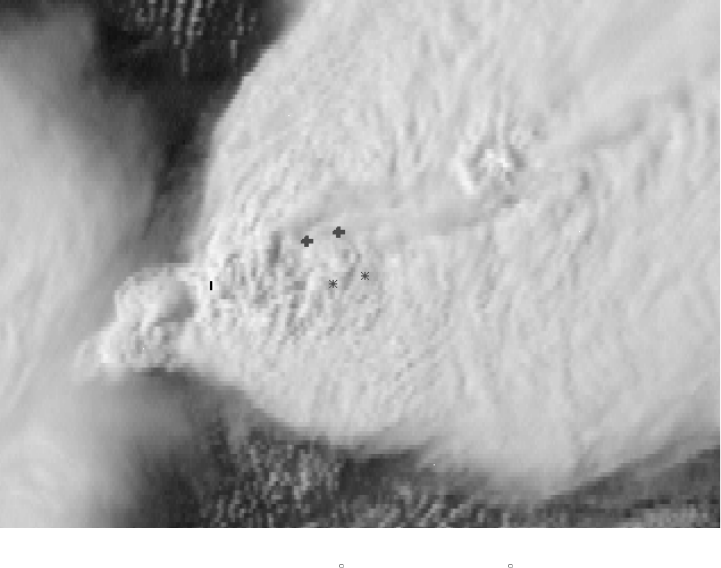
B-14
Figure 10a. One kilometer resolution visible image from GOES-8 displayed at a
0.25 km scale. The image is centered at 30 23’21" North and 98 00’45" West, the
beginning point of the Pedernales Valley tornado track. The time for the scan line at picture
center is 22:04:20 UTC. Both beginning and ending points of ground (*) and cloud top (+)
locations of the tornado track are shown.

B-15
Figure 10b. Four kilometer resolution GOES-8 infrared image matching the visible
image in Figure 10a. Minimum cloud top temperature in the overshooting top area is
-75 C. Beginning and end points of the tornado track (+) are mapped to a cloud top height
o
of 15 km.

B-17
Figure 12. Minimum overshooting cloud top temperature for the tornadic storm complex
versus UTC for GOES-8.
The relationship between overshooting tops, cloud top temperature and storm updraft intensity is
fairly well understood. It is instructive to inspect plots of minimum cloud top temperature for the
tornadic storm complex as a function of time for GOES-8 during the outbreak period. This is
done in Figure 12. It is interesting that the cloud top temperatures closest to the Moody, Belton
and Jarrell tornado times are all 4 to 5 C colder than a smooth curve fitting minimum cloud top
temperatures at non-tornado times. This apparent relationship is not as clear for the Cedar Park
or the Pedernales Valley storms.

B-16
Figure 11. GOES visible upper left; AVHRR visible upper right; GOES infrared lower
left; AVHRR lower right. The GOES imagery was taken near 2004 UTC while
the AVHRR imagery was taken approximately 1 minute earlier.
Between the times of the Belton and Jarrell tornadoes, NOAA-14 provided AVHRR imagery over
the tornado outbreak area. While GOES and AVHRR visible channel imagery is of comparable
resolution, AVHRR’s 10.7 m infrared channel provides 1-km resolution imagery versus the 4
km resolution available from GOES. The four panel image in Figure 11 may be used to compare
visible and 10.7 m imagery from GOES with that from AVHRR. The GOES and AVHRR
visible images have been enhanced to show detail at cloud top, while the same color enhancement
is used for the infrared images. Notice how well the enhanced GOES and AVHRR visible
imagery define cloud top features—the veil-like cirrus plume above the anvil can be seen
extending downwind from well-defined overshooting tops. In the corresponding infrared images,
those same features are less well defined in GOES imagery than in AVHRR imagery. Cloud top
temperature structure is better defined in the AVHRR imagery, with AVHRR minimum
temperatures in the overshooting top region approximately 10 C colder than in the GOES
imagery. In the AVHRR imagery, relatively warmer anvil downwind from the overshooting top
area is clearly surrounded on both downwind sides of the anvil by colder cirrus—the “enhanced-
V” signature. This comparison of AVHRR and GOES points to the potential for use of AVHRR
imagery as a companion to GOES imagery for convective nowcasting purposes.
B-18
Conclusions
Satellite data provided a number of valuable pieces of information for use in severe thunderstorm
nowcasting over Texas on May 27, 1997. The storm complex that produced the tornado activity
between Moody and Pedernales Valley on this day had features at cloud top that are often
associated with thunderstorms that have very intense updrafts: (a) overshooting tops in the visible
imagery; (b) veil-like cirrus plumes above the anvil extending downstream from the overshooting
top area; (c) cold top areas associated with the overshooting region that were colder than the
ambient anvil temperature; and (d) enhanced “V” shaped cold regions with warm wakes extending
downwind from the cold top area. It should be noted that cold cloud top features similar to these
were noted in other intense thunderstorm complexes that produced intense weather over Texas on
this day. The precise location, orientation and movement of the front along which the tornadic
storm complex evolved was easily monitored using GOES imagery.
Real-time data flow into a satellite analysis system with capability similar to RAMSDIS would
have allowed for a number of useful applications. Storm-relative animation would have revealed
that tornadic activity was confined to one major thunderstorm complex, highlighting the threat to
any who lay in the path of the storm and its intersection with the front. Imagery could have been
enhanced, revealing cloud top characteristics commonly associated with severe thunderstorm
activity.
As shown in Figure 12, there appears to be a relationship between storm intensity, as revealed by
cloud top temperature, and tornado activity. However, it is not possible to verify this with the 15-
minute imagery, because storm dynamics with intense tornadic storms such as these are very
strong, and explosive overshooting at cloud top may last for only a few minutes. It is indeed
unfortunate that the satellite was not placed in a 7 ½-minute severe storm observing mode during
the event, nor had a special 1-minute interval imaging day been requested for research purposes.
The AVHRR imagery should be included as a part of routine real-time satellite imagery provided
to field users; it also gives an enticing glimpse to what might be observed with higher resolution
infrared imagery from geostationary satellites.

C-1
Appendix C
Aerial Damage Survey of the
Central Texas Tornadoes
of May 27, 1997
Brian E. Peters
Warning Coordination Meteorologist
National Weather Service, Birmingham, Alabama
Introduction
During the afternoon of May 27, 1997, severe thunderstorms spawned a series of tornadoes over
portions of Central Texas from just south of Waco to west of Austin. As part of the NOAA
Service Assessment Team investigating the storm event, an aerial damage survey was conducted.
The intent of the aerial survey was to provide information to pinpoint the beginning and ending
points of the tornado tracks, as well as provide information on the Fujita Tornado Intensity Scale
(F-scale) along the track.
The aerial survey was conducted on Friday and Saturday, May 30-31, using a fixed-wing aircraft
flying at approximately 3,000 feet and a helicopter flying between 500 and 1,000 feet. Additional
aerial surveying was done on Monday, June 2, using a helicopter arranged by the Travis County
Emergency Management Agency and the Fire Marshal’s office. A total of about
9 hours of air time was logged in the flights. Some of that air time was spent in getting to and
between the various tornado tracks. Additional assistance was obtained by using a Global
Positioning System (GPS) and mapping software to accurately plot damage locations. The
GPS/software combination claims an accuracy of ±300 feet.
THE MOODY TORNADO
Maximum F-scale: F3
Path Length = 3.7 miles Path Width = 150 yds
Path Length by County: McLennan [3.2 miles]; Bell [0.5 miles]
Beg: 31 17.91’/97 20.16’ End: 31 14.91’/97 21.48’
The Moody tornado began on the southside Farm to Market Road (FM) 107, 1.6 miles east-
southeast of Moody in open country. The tornado traveled south-southwest moving across
Dowell Road where two structures, a house and a barn, were destroyed. Another structure, a
small house, was damaged just north of this location. A pickup truck and a car were each tossed
several hundred feet; the pickup truck to the left of the tornado path and the vehicle along the
path. The tornado continued south-southwest from Dowell Road, crossing the McLennan/Bell
County line covering open country with trees down in numerous locations.

C-2
Ground Track of the Jarrell Tornado
Maximum F-scale assignment was based upon the damage that occurred at only one location,
where the house and barn were destroyed. There was an absence of other structures to make an
effective assessment.
THE BELTON TORNADO
Maximum F-scale: F3
Path Length = 1.4 miles Path Width = 275 yds
County: Bell
Beg: 31 08.92’/97 28.29’ End: 31 08.01’/97 29.19’
The tornado began 6.5 miles north of Belton in an area called Morgan’s Point on the northside of
Belton Lake. The tornado moved from land along a slough with tree damage on the west side of
the slough. A number of structures also on the west side of the slough sustained damage which
appeared to be minor. Continuing south-southwest, the tornado crossed a bend in Belton Lake,
moving ashore just northeast of a community called Woodland. As the tornado moved ashore,
destruction to trees was nearly total, with substantial damage to at least six structures.
The tornado ended abruptly only 1/3 of a mile after coming ashore at a point 5.6 miles north-
northwest of Belton.
THE JARRELL TORNADO
Maximum F-scale: F5
Path Length = 7.6 miles Path Width = 3/4 miles
County: Bell [2.4 miles]; Williamson [5.2 miles]
Beg: 30 53.90’/97 35.20’ End: 30 49.18’/97 40.12’
The damage path associated with the Jarrell tornado actually begins in Bell County at a point
about 0.8 miles northwest of the Prairie Dell exit from Interstate 35, near mile marker 280. The
C-3
tornado tracked south-southwestward across open country. Damage was primarily to trees, with
only a couple of structures damaged.
The tornado remained primarily in open country as it crossed the Bell/Williamson County line
before taking a more southwestward turn that took it to the northwestern edge of Jarrell. The
tornado crossed the county line very close to where Williamson Road ends and County Road
(CR) 304 (Bell County) begins. The tornado crossed CR 308, CR 305, and then CR 307. Where
the tornado crossed each of these county roads, approximately 525 feet of asphalt was ripped off
each of the roadways. This particular destruction was believed to be very close to the centerline
of the tornado circulation.
Observations recounted by eyewitnesses and revealed in interviews made by other members of the
Service Assessment Team indicated that the damage path may not have been made strictly by one
tornado. A number of eyewitnesses reported seeing several small, rope-like funnels before the
character of the tornado changed drastically into the killer tornado.
As the tornado crossed the intersection of CR 305 and 307, a business on the corner was
destroyed. The tornado moved into the Double Creek Estates subdivision at this point with total
destruction. F5 destruction begins shortly after the tornado moved into Williamson County and
continued until very close to the end of the damage path.
Moving through the Double Creek Estates subdivision and the surrounding area, the tornado
widened to the maximum width of three-quarters of a mile. From the air, the ground appearance
changed abruptly in the vicinity of CR 308 and continued until very near the end of the path. No
definitive circulation patterns or suction spots were evident, but there was the noted obvious
change in the appearance of the ground.
In the Double Creek area, approximately 40 structures were totally destroyed. One of the most
striking signs in approaching this area was the distinct lack of debris of any size. Closer
inspection showed lots of little debris, but no sign of large items. At least half a dozen cars were
identified from the air lying in the open areas, most of them flattened and encrusted with mud and
grass. Later, a ground survey revealed that most of the debris that was left in the area was
extremely small, indicating the power of the tornadic winds. All 27 deaths associated with the
Jarrell tornado occurred in the Double Creek area.
After passing through the Double Creek area, the tornado moved across CR 309 and into a
heavily wooded area of cedar trees. The total destruction of the tornado ends abruptly shortly
after entering the wooded area. However, a small swath of tree damage on the north side of the
main damage path suggested the possibility of a multiple vortex pattern. No other evidence of
multiple vorticies was observed.

C-4
Ground Track of the Cedar Park Tornado
THE CEDAR PARK TORNADO
Maximum F-scale: F3
Path Length = 9.2 miles Path Width = 250 yds
County: Williamson [5.6 miles]/Travis [3.6 miles]
Beg: 30 33.39’/97 49.24’ End: 30 27.30’/97 54.11’
The Cedar Park tornado began about 3.5 miles north of Cedar Park, at a location 0.6 miles south
of CR 178 and 1.4 miles east of the intersection of US 183 and CR 178. The initial damage was
to trees, however, the ground survey revealed damage nearby to a church and a trucking
company. The aerial survey did not reflect this damage as being in line with the damage path. It
is quite possible this damage was caused by strong wind near the tornado. The beginning point
was in a relatively open area, with damage primarily to a few trees and minor shingle damage to
one house.
The tornado moved south-southwestward, skirting a residential area before it crossed CR 180
immediately east of US 183. It was at this intersection that an Albertsons grocery store was
severely damaged. The tornado crossed US 183, causing additional damage to a number of
businesses. One business on the west side of US 183 lost nearly the entire roof. Most damage to
other businesses was believed to be minor.
A historic train located on the north side of CR 180, just to the east of US 183, was in the direct
path of the tornado. While the engine remained on the track, a coal tender converted to hold
diesel fuel and weighing approximately 65,000 pounds, including the 1,000 gallons of diesel fuel,
was flipped over and thrown a short distance.
After crossing US 183, the tornado moved across Marquis Lane and North Park Circle through
an area with widely scattered housing and a relative abundance of trees. Most damage to
structures in this area was minor.
C-5
From North Park Circle, the tornado moved into the northwestern portion of Buttercup Creek, a
subdivision of well constructed homes. Damage to homes was irregular, with one house losing a
roof but the house next door losing only shingles. Damage ranged from F0 to F2. At this point,
the tornado track was taking a gentle right turn and became more southwesterly. The tornado
moved into a wooded area crossing into Travis County before ending 1.1 miles from Lake Travis.
Damage in the wooded area was irregular, ranging from near total destruction of all trees to
sections with about 10 percent of the trees down.

C-6
Ground Track of the Pedernales Valley Tornado
THE PEDERNALES VALLEY TORNADO
Maximum F-scale: F4
Path Length = 5.6 miles Path Width = 440 yds
County: Travis
Beg: 30 23.35’/98 00.75’ End: 30 22.39’/98 06.25’
The Pedernales Valley tornado began on the shore of Lake Travis, destroying trees and a floating
marina where nearly all of the watercraft were destroyed. While numerous trees were twisted and
uprooted in this area, several structures sustained only what appeared to be minor damage that
would be no more than F0.
The tornado was initially on a heading of 265 degrees as it moved into rough terrain. A number
of structures sustained varying damage until the tornado reached Bee Creek Road. At that
location, a Southwest Bell building housing telephone switching equipment was destroyed. The
building was well-constructed and was one of several buildings which indicated at F4 rating for
this tornado. Bee Creek Road takes a bend close to the telephone building, and across the street a
house was destroyed with walls knocked down.
Approximately 2.2 miles from the lake, the tornado path takes a distinct dog-leg turn toward the
southwest. The point at which this turn occurred also corresponds with a knoll. Trees and
buildings at the top of the knoll were destroyed.
After the turn, the tornado assumed a heading of 250 degrees and crossed a major power
distribution line. One steel tower was destroyed, bringing all lines to the ground. The tornado
remained on the 250 degree heading, moving through the area described as the Hazy Hills
subdivision. Numerous houses and several mobile homes were totally destroyed. Several houses
survived but sustained major damage that made them totally uninhabitable.
C-7
The only death associated with this tornado occurred here, when one man was killed. He lived in
a mobile home that was demolished and his vehicle was tossed several hundred feet. Service
Assessment Team members were unable to learn whether he was in the mobile home during the
storm or had left it to drive away.
The tornado continued west-southwest, moving across State Road (SR) 71. A number of well-
built homes in the Hazy Hills subdivision were heavily damaged or destroyed. Crossing SR 71,
the tornado moved into another subdivision with widely-separated houses in the Lick Creek
valley, a steep walled creek that feeds into the Pedernales River. One stone-walled house located
just north of Pedernales Drive and west of SR 71 was completely deroofed. Other structures in
this subdivision sustained roof damage in the F2 range. After following the terrain into the cree,
the tornado climbed another rise in the land before ending shortly after passing the crest of the
small hill. As the tornado ended, damage was minimal to trees.

D-1
Appendix D
Persons Interviewed and/or Contacted
by the Service Assessment Team
Name Date Affiliation
John Sneed 05/29/97 Williamson County Sheriff’s Department
Shawn Newsom 05/29/97 Williamson County Sheriff’s Department
Mike Faught 05/29/97 Georgetown Fire Department
Mark Moss 05/29/97 Chief, Georgetown Fire Department
Kevin McEleney 05/29/97 Jarrell Volunteer Fire Department
Larry Fore 05/30/97 Albertsons grocery store manager
Tim Travis 05/30/97 Cedar Park Police Department
Paul Christ 05/30/97 Austin Police Department
Pat Pingston 05/30/97 Post Net store owner
Nick Olarti 05/30/97 Taco Bell store manager
Bob Russell 05/30/97 Cedar Park fire department
Mrs. & Mrs. Jim McCarty 05/30/97 Buttercup Creek residents
Ken Van Rens 05/30/97 Chief, Pedernales Valley Volunteer
Fire Department
Steve Poulson 05/30/97 Pedernales Valley Volunteer Fire
Department
David & Ann Butler 05/30/97 Hazy Hills residents
Scott Beckwith 06/01/97 Jarrell resident
Cliff Tschoerner, Jr. 06/01/97 Jarrell Volunteer Fire Department
Joyce Wilson 06/01/97 Double Creek Estates subdivision resident
LaDonna Peterson 06/01/97 Double Creek Estates subdivision resident
Jaunitta Peterson 06/01/97 Double Creek Estates subdivision resident
Bonnie Hammett 06/01/97 Double Creek Estates subdivision resident
Ken Adams 06/01/97 Double Creek Estates subdivision resident
Steve Collier 06/02/97 Austin Office of Emergency Management
Eric Carter 06/02/97 Austin Office of Emergency Management
Joe Hidrogo 06/02/97 Austin Office of Emergency Management
Scott Swearengen 06/02/97 Austin Office of Emergency Management
Clay Shell 06/02/97 Georgetown Fire Department
Bob Rose 06/02/97 Lower Colorado River Authority
Geniva Simpson 06/02/97 Williamson County Sheriff’s Office
Richard Gasten 06/02/97 Travis County
Brad Beauchamd 06/02/97 Travis County
Pete Baldwin 06/02/97 Travis County Emergency Management
Chris Causen 06/02/97 Travis County Emergency Services
Bobby Dewsman 06/02/97 State Office of Emergency Management
D-2
Jo Moss 06/02/97 State Office of Emergency Management
Linda Moorer 06/02/97 State Office of Emergency Management
Steve Vaughan 06/02/97 State Office of Emergency Management
Ken Lott 06/02/97 Austin American Statesman newspaper
Clara Herrera 06/02/97 Austin American Statesman newspaper
Larry Kolvoor 06/02/97 Austin American Statesman newspaper
Dave Martis 06/02/97 KVET/KASE radio
Michael Schmid 06/02/97 Texas Association of Broadcasters
David Gaiewski 06/02/97 Time Warner Communications
George Warmingham 06/02/97 Austin Cablevision
Kenneth Pulliam 06/02/97 KDFW-TV
Cliff Morrison 06/02/97 KEYE-TV
Andrew Sowder 06/02/97 KTBC-TV
Kimberly Flemming 06/02/97 KTBC-TV
Mike Wenglar 06/02/97 KVUE-TV
Keith Harris 06/02/97 KVUE-TV
Mark Murray 06/02/97 KVUE-TV
Curtis Nichols 06/02/97 KVUE-TV
Brent Annear 06/02/97 KVUE-TV
Troy Kimmel 06/02/97 KTBC-TV
R. J. DeSilva 06/02/97 KXAN-TV
Dale Fuller 06/03/97 Cedar Park Emergency Management
Rodney Baden 06/13/97 McClennan County Emergency
Management
E-1
Appendix E
CDC Field Epidemiological-Health Report
Dr. Enrique Paz, Epidemic Intelligence Service
U.S. Centers for Disease Control and Prevention (CDC)
Dr. Shellie Kolavic, Epidemic Intelligence Service, CDC
and
Texas Department of Health (TDH)
David Zane, MS, Director, Injury Prevention and Control Program, TDH
Background
On May 28, 1997, the CDC received an invitation from the NWS to participate in a NOAA
Service Assessment Team in central Texas, where several tornadoes occurred on May 27. A
Texas-based CDC epidemiologist and a TDH injury epidemiologist joined a scientist from the
CDC to take part in the assessment. The CDC assessment was conducted from Friday, May 29,
to Monday, June 2, 1997.
Objective
The purpose of the CDC assessment was to describe mortality and morbidity related to the
tornadoes in the impacted population and to provide causal hypotheses for fatalities and injuries.
Assessment Methodology
Data-gathering techniques consisted of the following methods:
1. On-site observation
Time: 1-3 days
Resources: Automobiles, Texas Department of Transportation area maps
Indicators: Direct observations
Discussions with local leaders and health workers
Number of deaths
Number of injuries
E-2
2. Quick field surveys
Time: 2-3 days
Resources: National Weather Service
Texas Department of Health
Local hospitals
Newspapers and other media
Local law enforcement officials
Emergency Response Services
Williamson County Health Department
American Red Cross
Indicators: Rapid surveys, number of deaths, number of injuries
Results
Preliminary mortality and morbidity data was obtained from various sources, including the
American Red Cross, local hospitals, newspapers, television, and anecdotal information in the
field. This information was used to establish a base line for further surveillance and
epidemiological studies regarding the health impact and possible causal factors of tornado-related
deaths and injuries in the affected counties. Extensive damage, most notably in the Double Creek
Estates subdivision, hampered the assessment. No random sample or cluster sampling techniques
were conducted and no questionnaires were administered due to the gravity of the events, the
short period of our survey, and the lack of persons in the immediate area during our visits.
Fatalities and Injuries
A total of 30 deaths occurred: 27 (90 percent) in Jarrell, 1 in Pedernales Valley, 1 in Cedar Park,
and 1 in Austin. The 27 people died from multiple trauma; the other deaths were caused by heart
attack, suffocation, and drowning. The mean age of the decedents was 27 years and the range
was 5-69 years. The mean age for male decedents was 24 years; for females, the mean age was
33 years. These deaths directly affected 13 family units.
In Jarrell, 27 deaths occurred in the Double Creek Estates subdivision that had an estimated
population of 132. The mean age of the decedents was 26 years and the range was 5-51 years.
Of those who died, 14 were male (52 percent) and 13 were female (48 percent). Fourteen (52
percent) school-aged persons died. Ten families experienced two or more deaths; one family of
five perished. The deaths in Jarrell represented 7 percent of that town’s 1993 population.
In Cedar Park, one death (a male, age 69) occurred from cardiac arrest, probably due to storm-
related stress. In Austin, one person (a female, age 38) drowned in a storm-swollen creek. In
Pedernales Valley, one mobile home resident (a male, age 25) died. It is unclear where the
E-3
decedents were located during the storms. None of the decedents lived in residences with
basements, and most of the dead were recovered various distances from their homes. Several
Double Creek Estate residents survived in bathtubs, while others successfully sheltered in a
neighbor’s storm cellar. This was apparently the only underground shelter in this subdivision.
Local hospitals reported that a total of 33 persons (13 from Jarrell, 15 from Cedar Park and
5 from Pedernales Valley) were treated for tornado-related injuries. One of the 13 injured from
Jarrell died in the emergency room. Overall injuries, many multiple, included lacerations
(55 percent), contusions (46 percent), abrasions (30 percent), strain/sprain/muscle spasm
(18 percent), penetrating wound (0.03 percent), fracture (0.06 percent), and closed head injury
(0.03 percent). The median age of the injured persons was 38 years with the range 1-75 years.
Twenty-six injured persons were treated and released, one injured person died in the emergency
room (as noted above), and five persons were admitted. The median length of hospital stay was
11.5 days and the range was 1-31 days. Four persons were discharged home and one to an
inpatient rehabilitation facility.

E-4
Table 1. Mortality Data by County and Affected Area
County Town or Place Age Sex
Williamson Jarrell
51 F
46 M
46 F
45 F
41 M
40 F
40 M
40 F
38 F
36 F
36 F
35 F
21 M
17 F
17 M
17 M
16 M
16 M
15 M
15 M
15 M
14 F
14 M
13 F
11 M
10 F
5M
Cedar Park
69 M
Travis Shoal Creek
Austin
38 F
Pedernales Valley
25 M
Sources of information: American Red Cross/CDC surveillance system and Texas Department of Health.

E-5
Table 2. Preliminary Descriptive Analysis
Williamson Co. Travis Co.
Total
Jarrell Cedar Austin Pedernales
Park Valley
Fatalities 30 27 (90%) 1 1 1
Males 16 14 (52%) 1 0 1
Females 14 13 (48%) 0 1 0
Mean age 27 26 69 38 25
Min age 5 5
Max age 69 51
Mean age males 24 21
Mean age females 33 32
Deaths under 14 14
18 years old
Affected families 13 10
Families with 9 9
more than 1 death
Conclusions
The majority of reported deaths occurred in Jarrell, in the Double Creek Estates subdivision. In
Cedar Park, there was one reported death, and 15 injured persons were treated at local hospitals.
In Austin, one drowning occurred. In the Pedernales Valley area, there was one reported death,
and 5 persons were treated at local hospitals.
Limitations of the Survey
This survey has some limitations because quantitative data were unobtainable and access was
limited by the devastating impact of the event. The data collection provided partial information
and may be limited by selection bias. A comprehensive survey that included a questionnaire was
not administered due to the short field visit.

E-6
Recommendations
Encourage the recovery efforts of the affected population.
Continue collecting data from the American Red Cross-CDC surveillance system, Texas
Department of Health, hospitals, and other data sources related to fatalities and injuries for the
final report.
Follow up with data sources regarding risk factors and causal factors of the mortality and
injuries due to the tornadoes in different areas, particularly in Jarrell.
Continue improving warning systems and develop future technology to prevent fatalities and
injuries.
Continue effort in prevention, disaster mitigation and education in local communities.

F-1
Appendix F
Fujita Tornado Intensity Scale
The Fujita Tornado Intensity Scale is a scale of wind damage intensity which wind speeds are
inferred from an analysis of wind damage.
Category Definition and Effect
F0 Gale tornado (40-72 mph): Light damage. Some damage to chimneys; break
branches off trees; push over shallow-rooted trees; damage sign boards.
F1 Moderate tornado (73-112 mph): Moderate damage. The lower limit is the
beginning of hurricane wind speed; peel surface off roofs; mobile homes pushed off
foundations or overturned; moving autos pushed off the roads.
F2 Significant tornado (113-157 mph): Considerable damage. Roofs torn off frame
houses; mobile homes demolished; boxcars pushed over; large trees snapped or
uprooted; light-object missiles generated.
F3 Severe tornado (158-206 mph): Severe damage. Roofs and some walls torn off
well-constructed houses; trains overturned; most trees in forest uprooted; heavy
cars lifted off ground and thrown.
F4 Devastating tornado (207-260 mph): Devastating damage. Well-constructed
houses leveled; structure with weak foundation blown off some distance; cars
thrown and large missiles generated.
F5 Incredible tornado (261-318 mph): Incredible damage. Strong frame houses lifted
off foundations and carried considerable distance to disintegrate; automobile-sized
missiles fly through the air in excess of 100 yards; trees debarked; steel-reinforced
structures badly damaged; incredible phenomena will occur.
S-1
Status of Actions
April 1998
Recommendation 1:
Personnel at NWSFO EWX should be trained in how to turn on the amateur radio equipment so
that they can at least hear reports, even if the network is not activated. NWSFO EWX should
also work with the amateur radio coordinator on backup procedures for contacting key people in
impending emergencies.
Status:
Personnel at NWSFO EWX were given instructions during the late summer of 1997 on how to
turn on and monitor amateur radio equipment in the event no amateur radio operator is on duty to
operate the equipment.
Recommendation 2:
The NOAA and the NWS should increase efforts in working with the DOD to ensure that DOD
commanders and personnel understand that properly maintained and operated DOD WSR-88Ds
are vital to the severe weather warning programs for both the bases and the civilian populations
under the radars’ umbrellas.
Status:
Since the early days of the deployment of the tri-agency WSR-88D network, there has been an
ongoing concern at the NEXRAD Program Management Committee of the radar maintenance
program capability. The GAO brought this factor to closer scrutiny in a 1995 report titled
"Weather Forecasting--Radar Availability Not Being Met" (AIMD-95-132). Following the
publication of this report, senior NWS and USAF senior management met to discuss these issues
and agreed that the USAF would cooperate in any way possible to support the NWS mission.
Lines of communication were established between DOD and NWS technical personnel for quick
problem resolution.
In recent months, DOD availability has matched the tri-agency standard of 96 percent, and there is
no systematic problem with the WSR-88D maintenance program.
Recommendation 3:
The NOAA/NWS should move rapidly to ensure that all Weather Forecast Offices (WFOs) in the
NWS are equipped with the best possible satellite analysis capabilities that are part of the
Advanced Weather Interactive Processing System (AWIPS). The NWS should also provide
proper training to ensure that satellite data are used in the warning and forecast program.
Status:
As of the end of March 1998, AWIPS is being used in operations at 20 WFOs and 8 River
Forecast Centers. The next group of AWIPS sites will be deployed this summer at 15 WFOs and
3 RFCs. Authorization for nationwide deployment of the remaining systems is pending from the
S-2
Secretary of Commerce. The offices that currently have AWIPS are accessing the high-resolution
data from geostationary satellites. With AWIPS, these satellite data can be integrated with radar
data, observational data, and numerical model data in a way never before available to operations.
The NWS will complete the initial phase of training on using the new GOES satellite by June
1998 via the following methods: (1) Provision of an in-depth, 2-week course on mesoscale
satellite meteorology at COMET; (2) Completion of a series of three computer-based learning
modules; (3) Establishment and maintenance of a Satellite Meteorology Web page.
Recommendation 4:
The SPC should make every effort to coordinate with any NWS office that has warning
responsibility before a watch is issued that covers a part of the CWA of that NWS office.
Status:
The SPC concurs that it did not coordinate with the Austin-San Antonio NWSFO prior to issuing
the Tornado Watch in advance of the Jarrell tornado.
The SPC is working with the Office of Meteorology, NWS Headquarters, to instigate the
teleconferencing call lists needed to ensure such oversights cannot happen in the future. The
NWS plans to have these lists in place nationwide by June 1, 1998.
Recommendation 5:
The OSF should evaluate the Level-2 Archive data from the EWX radar and further investigate
these anomalies. The NEXRAD Program should continue its plans to implement the National
Severe Storm Laboratory’s experimental mesocyclone algorithm because of its higher skill and
informative outputs, including probabilistic guidance values.
Status:
On June 18, 1997, Don Burgess, Chief, Operations Branch, Operational Support Facility,
delivered a report to the Service Assessment Team. Conclusions from that report were included
in the Event Summary.
The NEXRAD Technical Advisory Committee is charged with evaluating experimental algorithms
to review proposed scientific changes and additions. The tri-agency System Recommendation and
Evaluation Committee approves and prioritizes proposed changes to the WSR-88D baseline.
Recommendation 6:
A thorough scientific study of these events should be undertaken by researchers and academicians
with the results made available to forecasters of the NWS. Any study should include the U.S.
Weather Research Program (USWRP), the NWS Collaborative Science, Technology, and Applied
Research Program (CSTAR) and NOAA/NWS Cooperative Institutes.
Status:
S-3
Scientific research on the Jarrell, Texas, tornado is being undertaken by the university community,
NOAA Cooperative Institutes, and NWS personnel, often in close collaboration. During the
CSTAR Workshop held October 7-10, 1997, a special session on the Jarrell tornado was
presented to illustrate science and service issues that must be addressed in order for forecasts and
warnings of extreme weather events to be improved in the future. Presentations were given by
researchers from the NWS and NOAA Cooperative Institutes. The workshop was attended by more
than 60 representatives from the universities, the NWS, other NOAA research laboratories, and the
USWRP.
The full workshop report can be found on the Internet at:
<http://www.nws.noaa.gov/om/cstar97.htm>.
Recommendation 7:
Use and interpretation of the WSR-88D data, especially in convective situations, should be left to
meteorologists trained in both mesoscale meteorology and the interpretation of WSR-88D data.
In addition, NWS WFOs should be appropriately staffed with a sufficient number of such
meteorologists to meet these requirements. Further, the NWS needs to ensure that any future
training programs being developed to replace the OSF WSR-88D course should be of equal or
better effectiveness than was that course. Meteorologists must have the ability to quickly
interpret reflectivity and velocity signatures within the context of the overall mesoscale weather
pattern, and relate the radar information to the other analyses and observing tools such as a
detailed mesoscale surface analysis combined with satellite, surface observations, profiler and
radar Velocity Azimuth Display (VAD) vertical wind profiles, etc. Accordingly, the NWS should
ensure that the expertise, materials, and other resources, including field staff time, are made
available to meet such a training requirement.
Status:
The NWS Southern Region policy regarding the operation of the WSR-88D and the interpretation
of radar data was restated to all NWSFOs in a memo dated July 9, 1997.
The Operations Training Branch of the OSF is developing a set of on-site training modules to
replace the in-residence WSR-88D course. The Distance Learning (DL) Operations Course
consists of printed materials, CD-ROMs, Web-based materials and Teletraining. The same final
exam will be used in the new DL version to ensure the course is equally effective. All Southern
Region meteorologist interns are currently in training using the modules which have been
released.
Recommendation 8:
Management at NWSFO EWX should establish and enforce clear lines of authority and
responsibility to be followed during severe weather operations. Further, emphasis should be given
to keeping all staff current regarding such operational procedures.
Protection of life and property is the fundamental mission of the NWS. NWS offices need to
develop a strategy for a coherent product suite encompassing warnings, statements and short-
term forecasts throughout severe weather episodes. They need to work with customers to apprise
them of priority which will be placed upon products during such events. All NWS WFOs should
S-4
have a standing policy that routine products have a much lower priority during periods of ongoing
severe weather. They should ensure that all staffing resources be brought into a cohesive severe
weather mind set and that the focus of the office is always on the fundamental mission.
Status:
Management at NWSFO EWX has instructed the staff regarding lines of authority, i.e, that the
Forecaster in Charge on shift has the responsibility to assign tasks during significant weather
events. Also, existing policy regarding priority of duties has been reemphasized to the staff and
such instructions are included in the Station Duty Manual.
Recommendation 9:
The staff at NWSFO EWX is commended for their dedication and extra effort to seek
confirmation that warning information was being received by officials who had a critical need for
it. Nevertheless, it is recommended that NWSFO EWX work with emergency management
officials to seek alternative and more efficient methods to confirm receipt of warnings.
Status:
NWSFO EWX efforts are ongoing to promote the Emergency Managers Weather Information
Network (EMWIN) technology for the dissemination of NWS warnings as well as the NOAA
Weather Radio SAME (Specific Area Message Encoding) technology. EMWIN is a personal
computer-based system using inexpensive, user-friendly software that provides warning and
forecast products, graphics, and limited satellite imagery in near real-time. A SAME-capable
receiver allows the user to program the weather radio to receive warnings for the areas of the
user’s choosing.
Recommendation 10:
The NWS should reach consensus with the Federal Emergency Management Agency (FEMA) and
the state emergency management agencies on a single communication/coordination system that is
consistent nationally and meets the internal and external communication/coordination
requirements of both the NWS and the emergency management community. All NWS offices
should be provided with needed technology to facilitate efficient internal and external
coordination.
Status:
The Office of Meteorology and FEMA’s Information Technologies Directorate have examined a
number of communication technologies over the past year. Currently, neither FEMA nor the
NWS have the funding necessary to complete the NAWAS Upgrade started in 1996.
In response to the continuing requirement for a National coordination/communication system, the
NWS Office of Meteorology (OM) and the Office of Systems Operations (OSO) have identified
FTS2000 as an interim system that can meet the basic internal and external coordination
requirements of NWS field offices and National Centers. The goal is to have the interim FTS2000
system operational by the end of June 1998.
Recommendation 11:
S-5
The NWS has sent to the Federal Communications Commission (FCC) proposed revisions to the
EAS rules. The NWS should continue to work with the FCC to clarify situations that need
automated activation. The NWS and the FCC, in cooperation with the National Association of
Broadcasters, should agree on a limited set of critical weather warning products which would be
programmed for automatic activation of the EAS.
Status:
The NWS works very closely with the FCC on all matters relating to the EAS. The FCC is
expected to adopt NWS-generated proposals in the fall of 1998 that include the optional use of
many more non-weather related and a few more weather-related EAS event codes.
The EAS media facilities, however, are not required by Federal law (FCC Rules, Part 11) to
disseminate any messages other than Presidentially-declared disaster information. If EAS facilities
choose to broadcast local emergency information, whether from the NWS or other authorities,
they have the option to either automatically activate or delay for later manual activation.
Furthermore, many EAS facilities want to use their own broadcasters rather than use NWR
broadcasts directly. These actions are decided and documented in local EAS Plans across the
country on a case-by-case basis. The NWS participates in these local plans via the efforts of the
WCM and designated staff.
Recommendation 12:
The NWS should continue to work with the state of Texas Division of Emergency Management
to seek ways to improve the timely transmission of weather warnings via TLETS and should
intensify efforts on both a local and state level to explore alternative methods of communicating
critical weather products to emergency management officials.
Status:
Working relationships with the Texas Division of Emergency Management have been greatly
expanded during the past 10 months. Changing the TLETS to a fully automated system is a state
funding issued beyond the control of the NWS. The NWS continues to promote the Emergency
Managers Weather Information Network and NOAA Weather Radio with SAME capabilities.
Recommendation 13:
The NWS should develop additional partnership initiatives with the public and private sector to
encourage the use of NWR for the receipt of critical weather information.
Status:
With the FCC’s adoption of NWR’s digital protocols for the new EAS, the NWR now becomes
the NWS’s primary input into this nationwide warning delivery service. Much interest and
visibility has already been generated by NWR input to the 14,000 some participating radio and TV
stations across the country. Starting in 1999, cable TV will join the EAS and can optionally
broadcast, for the first time, NWS warnings via NWR.
S-6
Recommendation 14:
All the NWR transmitters should be equipped with backup power.
Status:
A large minority of NWR transmitters do have backup power. Many of these typically are
systems co-located or associated with commercial broadcast facilities. Others with backup power
are found within large government or commercial buildings.
There is no backup power for the majority of transmitter sites because it is cost-prohibitive to
install generators at more than 400 locations, provide personnel with special knowledge on
generator maintenance and logistical support, and comply with EPA regulations on fuel storage
and containment.
Recommendation 15:
The NWS, in concert with FEMA and the ARC, should continue to emphasize the importance of
not attempting to flee an approaching tornado and reemphasize the importance of adhering to
long established tornado safety rules. (In the vast majority of situations, people who take shelter
in sturdy, well-built structures will survive most tornadoes whereas people who try to flee in
automobiles will place themselves at much greater risk.) The Service Assessment Team also
recommends that there be significant public and industry education on the meaning of well-built
tornado shelters.
Status:
The NWS remains a strong player in the National Disaster Education Coalition and will continue
to work within the coalition to effect this recommendation. The coalition consists of
representatives from FEMA, the U.S. Geological Survey, NWS, and The American Red Cross.
In meetings after the Jarrell tornado, the coalition agreed that tornado safety measures should not
be modified. It agreed to continue to emphasize the standard tornado safety measures well before
the recommendations from Jarrell were published realizing those safety measures still applied.
The current 12-page, tri-agency brochure “Tornadoes...Nature’s Most Violent Storms” explicitly
explains the long established tornado safety rules. Other Red Cross pamphlets also fully detail
these same consistent safety messages. The NWS will ensure that any future tornado brochures
will strengthen this message. The coalition will continue to support this recommendation, not
only in printed material but in all other venues.
The NWS has worked with local media in the central Texas area (primarily through efforts of the
EWX WCM) to reemphasize the importance of existing tornado safety rules. We have also
communicated the importance of reemphasizing this message to all our WCMs in the Southern
Region through routine coordination calls.
S-7
Recommendation 16:
The NWS should partner with other public agencies and the private sector to develop plans for
protection of employees and the public located in large buildings during severe weather threats.
Status:
The process for developing a network of public shelters has been in place for many years. As part
of the emergency management’s all hazard response, each state is required to develop a shelter
network to meet the evacuation and sheltering needs of its citizens. Many states have legislated
that counties and cities identify shelter space within public meeting places, such as court houses
and shopping malls. In addition, local Warning Coordination Meteorologists are constantly
working with emergency managers to educate the public on how to protect themselves. For the
past 5 years, the NWS has partnered with FEMA and the American Red Cross to produce and
distribute natural hazard awareness materials necessary to heighten the public’s awareness.
Recommendation 17:
First, the NWS should ensure that all field offices develop strategies that make full use of all office
personnel qualified to assist in warning and forecast operations during critical weather situations.
Second, the NWS should evaluate its plans regarding future staffing and service changes to ensure
that workload constraints do not compromise the agency’s safety of life and property mission.
Specifically, transitional staffing which has been placed at selected offices should be retained until
such time as new technology can demonstrate it is capable of mitigating the workload associated
with warning and forecast operations to an extent that a reduction in staff is feasible.
Status:
See Recommendation 8.
On February 26, 1998, NWS senior managers met to discuss AWIPS capabilities and field office
staffing requirements. They agreed to maintain transition staffing at NWS offices with multiple
associated WSR-88Ds and at offices with heavy NWR programming loads until the software
builds of AWIPS provide the necessary functionality to assist effectively and efficiently in the
delivery of these services. The Southern Region has ensured that staffing levels at offices meet
these guidelines.
Recommendation 18:
Studies should be undertaken by the research and academic community to help identify these
types of patterns which may aid in the development of these rare but catastrophic tornadoes.
Such studies should have the participation of the USWRP, CSTAR, and NOAA/NWS
Cooperative Institutes. The results of these studies should be made available to NWS forecasters
to aid in the warning and forecast process.
Status:
See Recommendation 6.
Recommendation 19:
S-8
NOAA/NWS should compile a list of potential, quick-response team members, drawn from
appropriate expertise in the NOAA line and staff offices, other Department of Commerce Bureaus
such as NIST, and from the universities and private sector. The team should be interdisciplinary
in nature. Following a significant tornado outbreak, a team of three to five scientists should be
assembled and dispatched to the centroid of the outbreak within 24 hours. Teams should include
meteorologists, a wind engineer, and a social scientist, an epidemiologist and a public affairs
specialist. Funding to carry out the travel costs of the team and an aerial damage-mapping survey
should be set aside yearly in a revolving budget.
Status:
NOAA line offices led by the NWS have partnered with FEMA, the U.S. Geological Survey, and
the Department of Agriculture in the development of a Post-Storm Data Acquisition (PSDA)
capability. Funding for the PSDA is shared by the participating agency partners. The NWS has
allocated an annual funding of $300K to meet post storm event assessment needs. The oversight
responsibility and activation of the PSDA resides with the Office of the Federal Coordinator for
Meteorological Services (OFCM). The OFCM, with assistance of the participating agencies has
drafted an plan for timely and coordinated post storm data collection.
To meet the aerial support requirement for damage-mapping, the OFCM, with the assistance of
the Office of Meteorology, has secured a Memorandum of Understanding between the OFCM and
the Civil Air Patrol. The data collected and the post storm reports will be made available to
agencies who are represented at the OFCM and to the remainder of the research and operations
communities through the OFCM Web page.
Currently, the NWS and OFCM attempt to field and deploy rapid service assessment teams within
24 hours of the event. The greatest limitation to date has been the small pool of human resources
available for these teams. The Office of Meteorology has proposed that the NWS and OFCM
support the development of a quick response training program to meet the demands being placed
on this small cadre of individuals. The goal is to identify, train and support individuals in the
deployment of quick response teams on a regional basis.
The NWS already have several names from volunteers and from people suggested by other
elements of the agency. OM will continue to add to it as the opportunity arises.
